Last edited: March 25, 2024
Published: March 25, 2024

Orbify
Earth Intelligence Specialists
Blog Post
Last edited: March 25, 2024
Published: March 25, 2024
Orbify
Earth Intelligence Specialists
At Orbify, our dedication lies in delivering a top-notch geospatial data platform and providing you with the support you need to achieve your goals.
Our Geospatial Data Platform automates the analysis of satellite imagery through AI and ML models to streamline the measurement and assessment of natural assets, providing environmental insights within a few clicks!
Each month, we strive to improve and get better, ensuring that our platform meets your evolving needs.
So, let's delve deeper into the latest updates and enhancements and explore how they can benefit you!

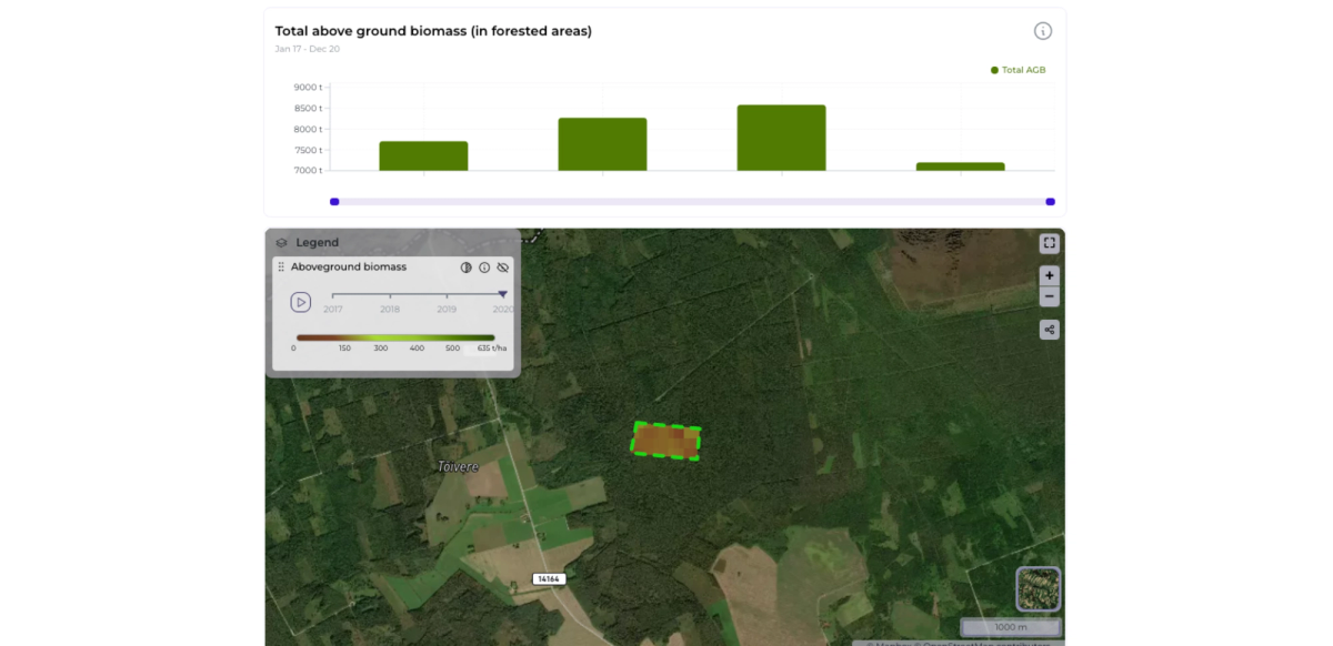
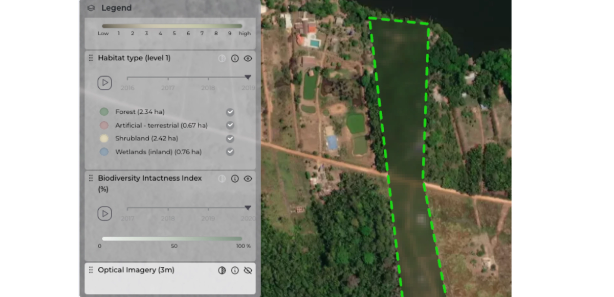
We've introduced a new feature: the AGB chart + timeline layer, allowing users to review the concentration of above-ground biomass (AGB) over time!
AGB, measured in tons per hectare (Mg/ha), represents the dry weight of woody parts of living trees, excluding stumps and roots.
Our dataset, derived from Copernicus Sentinel-1, Envisat's ASAR, and JAXA's ALOS-1 and ALOS-2, along with other Earth observation sources, provides per-pixel estimates of AGB for 2020, with uncertainty expressed as standard deviation in Mg/ha.
This data, part of the European Space Agency's Climate Change Initiative, benefits from revised allometries based on an extended record of spaceborne LiDAR data from GEDI and ICESat-2 missions, ensuring enhanced accuracy and reliability.

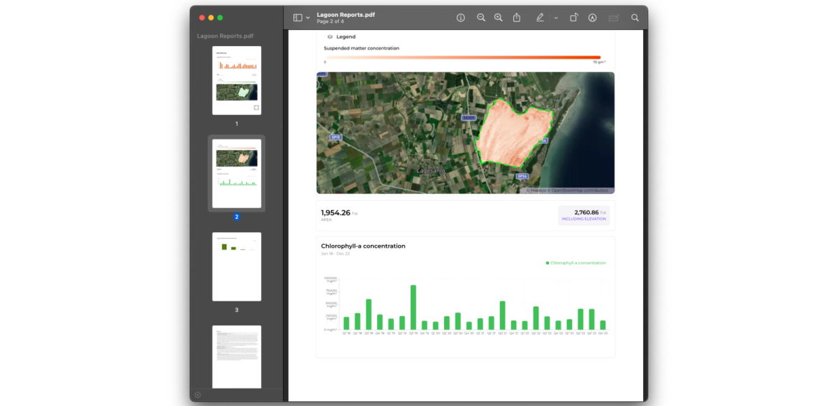
Our team has made substantial improvements to the print version of our reports, enhancing the overall layout, section organization, and map presentations.
These enhancements include the implementation of dedicated layouts to address various layout-related issues, smarter handling of report sections and page breaks, and an improved method for presenting maps in the report.
With these changes, the map legends no longer overlap critical map elements, and each map layer now has its own dedicated map container to ensure visibility within the report.
These updates aim to provide a more streamlined and visually appealing experience for our users when generating and viewing PDF reports.
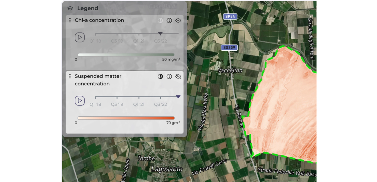
To enhance user experience in the layer selector component, we've revamped the presentation of visible and hidden layers, ensuring a more intuitive and streamlined interface. This update aims to improve usability and make it easier for users to manage their selected layers effectively.
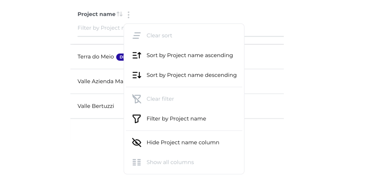
We've implemented the capability to filter and sort all listed projects, accompanied by significant performance enhancements. This improvement streamlines navigation through projects, making it easier to filter and organise them effectively.
We've recently integrated another set of OGC compliant standards for sharing Orbify data with our customers. Now, layers created with our platform are accessible through a dedicated tile server, enhancing data sharing capabilities. Stay tuned for upcoming support for WMS and WMTS standards!
We're excited to announce the availability of high-resolution data on our platform. We've been testing various methods to obtain different types of high-res images, showcasing how our platform continues to evolve and improve over time.
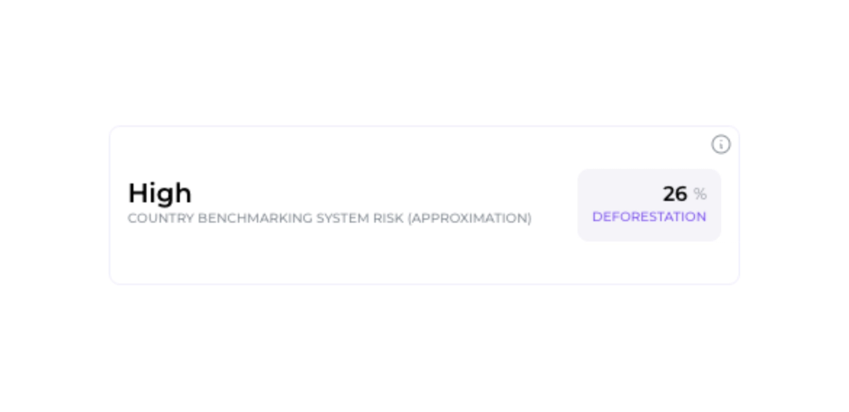
Leveraging our proprietary country-level deforestation risk dataset, we can assess the risk of deforestation at the national level in accordance with EUDR guidelines.
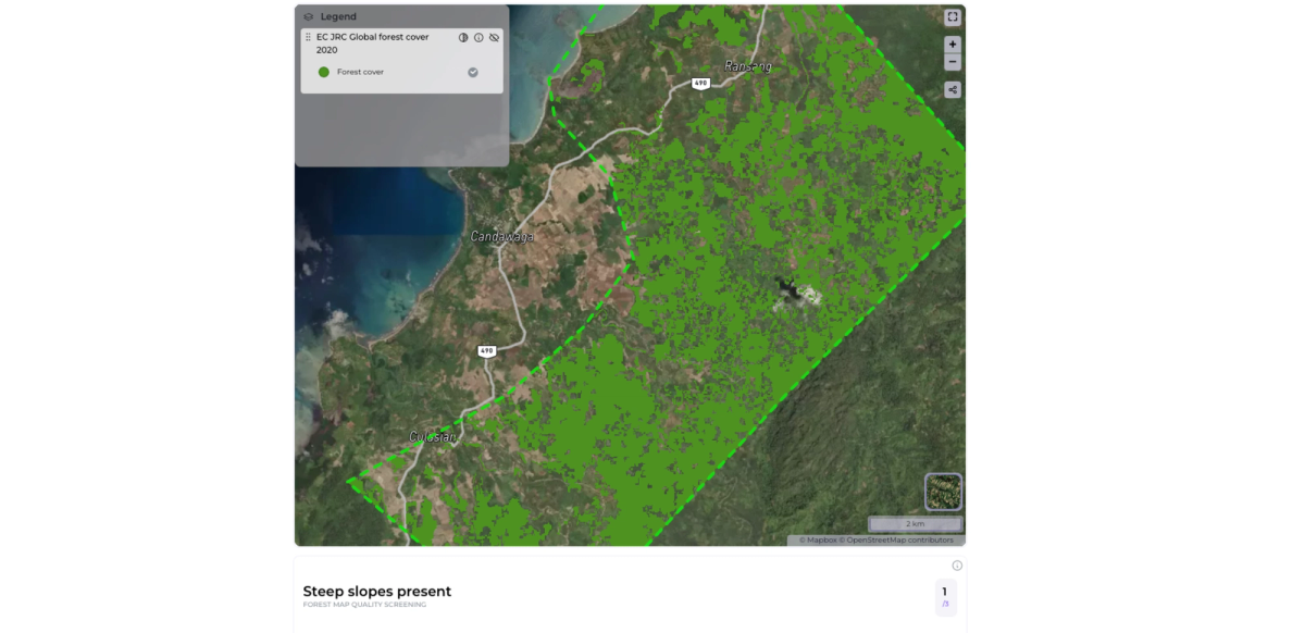
We have integrated the EC JRC Global Forest Cover dataset, featuring a10x10m cover map from 2020 from Joint Research Centre.
We have expanded our protected areas dataset for Brazil by integrating data from Instituto Chico Mendes de Conservação da Biodiversidade (ICMBio). This enhancement provides much more detailed information on protected areas within Brazil, allowing for better-informed decision-making and conservation efforts.
We've enriched our indigenous territories component by incorporating data from Fundação Nacional dos Povos Indígenas, offering more comprehensive information on indigenous territories in Brazil.
Stay tuned for even more exciting updates coming soon! We're thrilled to share them with you in our next product update.