Last edited: July 16, 2024
Published: July 16, 2024

Orbify
Earth Intelligence Specialists
Blog Post
Last edited: July 16, 2024
Published: July 16, 2024
Orbify
Earth Intelligence Specialists
We are excited to introduce a brand-new, dedicated view of our data components, directly accessible within our platform!
What’s New?
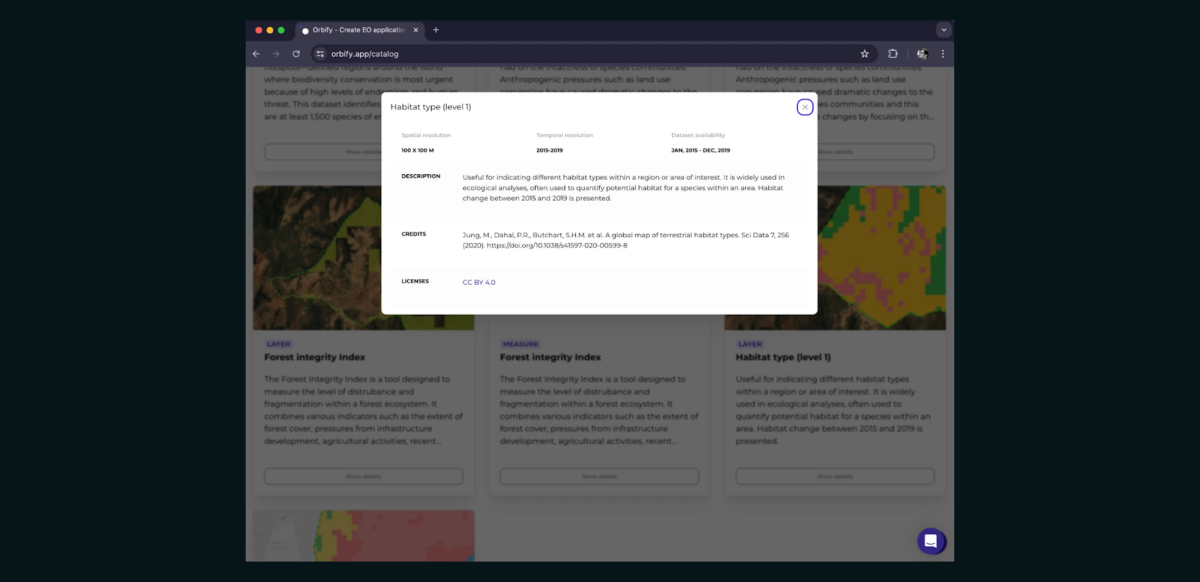
Log in to our platform and explore the catalog today Orbify Data Catalog!
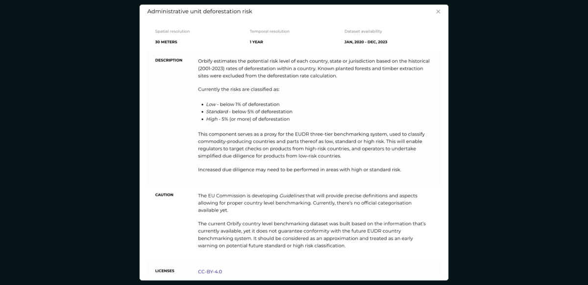
Country-Level Risk Benchmark for EUDR template
We have made significant improvements to our Country-Level Benchmarking System for the EUDR template, refining our score estimates by excluding known planted forest locations and aligning more closely with the EU's anticipated future scoring system.
Key Points:
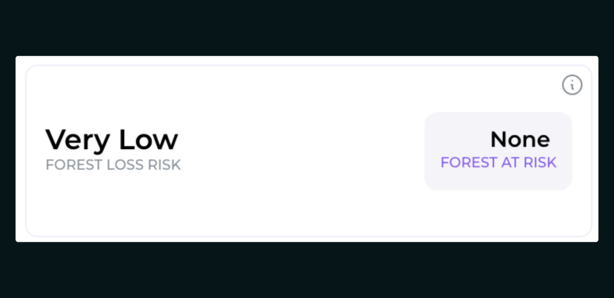
Forest Risk Assessment Updates (Beta Version)
Our latest enhancements to the forest risk assessment improve readability and offer precise, actionable insights. The updated assessment considers various risk factors, including:
Each factor is individually assessed and weighted for its correlation with deforestation risk.
New Climate Hazard Risk Template
We've introduced new components to enhance our upcoming "Climate Hazard Risks" report template! Here's what you can look forward to:
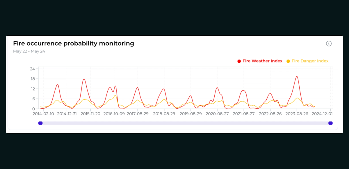
This template is designed to help users identify vulnerable areas and guide their decision-making processes effectively. It provides a comprehensive overview of the plot and includes detailed analyses such as flood risk assessment using multi-criteria models, drought risk evaluation with the Combined Drought Indicator, and fire risk analysis using the Canadian Fire Weather Index. The final output is a detailed layer highlighting areas with high risks from these climate hazards, facilitating the planning of resilient carbon offset projects.
New Components for “Climate Hazard Risks” Report
In addition to these updates, we’ve introduced new components that will enhance our upcoming “Climate Hazard Risks” report template:
Log in to our platform and explore our new template today Orbify Data Catalog!
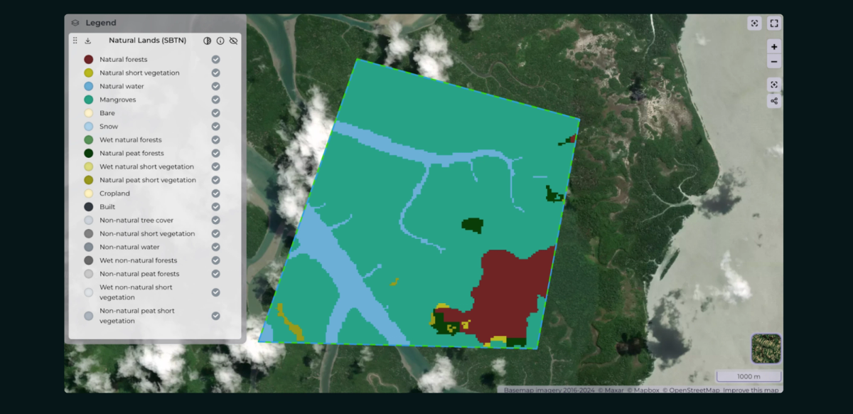
We've introduced new Natural Lands Layers, designed to provide a comprehensive understanding of natural ecosystems.
About the Natural Lands Layers
Created in collaboration with the World Resources Institute’s Land and Carbon Lab, WWF, and Systemiq, these maps support the Science-Based Target Network's Land Targets initiative. They serve as a 2020 baseline for companies aiming to meet Target 1: “No conversion of natural ecosystems.”
Key Features
Thank you for being a member of the Orbify community!
Stay tuned for more updates as we continue to enhance our platform to better serve your needs!
Need a Help? Book a Call!