Last edited: January 25, 2024
Published: January 24, 2024

Orbify
Earth Intelligence Specialists
Blog Post
Last edited: January 25, 2024
Published: January 24, 2024
Orbify
Earth Intelligence Specialists
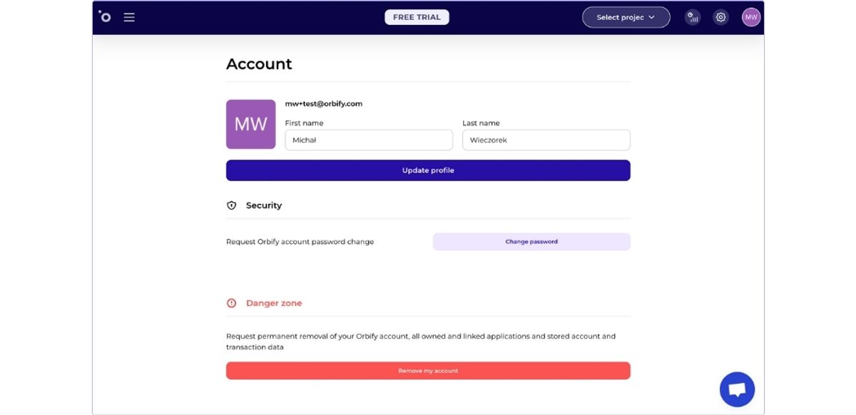
User self-service features enable individuals to independently manage their passwords and submit requests for account removal.
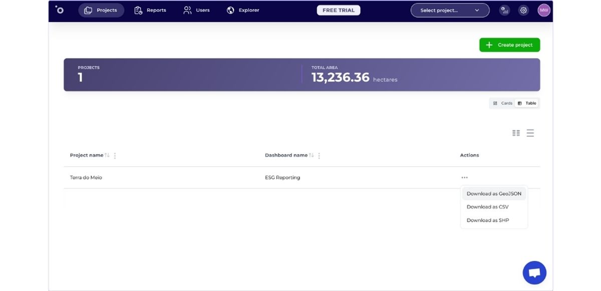
This new view allows to quickly navigate through all the dashboards created for projects, with the ability of creating customizable columns for displaying specific project data.
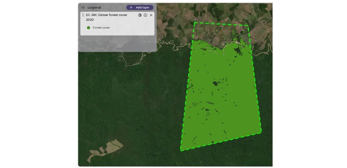
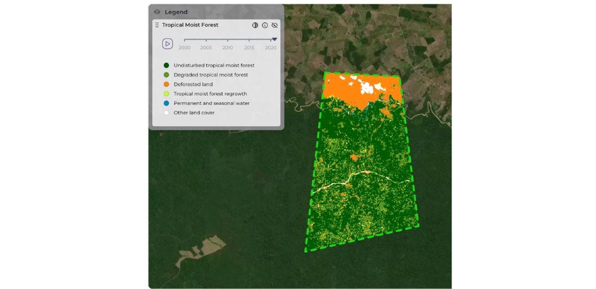
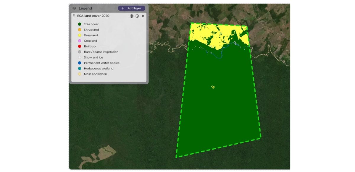
The following datasets are all useful in the assessment of the ‘deforestation-free’ requirement in the due diligence statement of the EUDR. These all contribute to the key ‘global map of forest cover for year 2020’ benchmark dataset
- Tropical Moist Forest Layer
This dataset offers a map of tropical forests with a 10m resolution for 2022 and 30m before then. It's particularly valuable for analyzing tropical forest dynamics and disturbances on a specific plot, which other datasets might miss. Primarily aiding in European Union Deforestation Regulation (EUDR) compliance, it's also beneficial for assessing forest health for biodiversity purposes.
- ESA Land cover layer
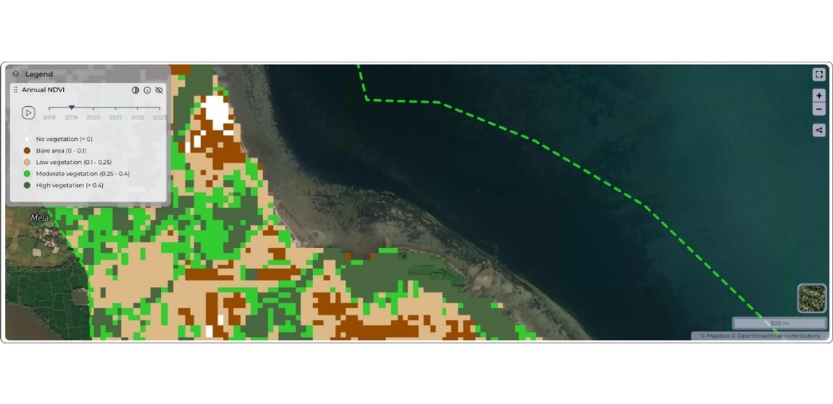
This land cover map, favored by Copernicus for generating the EUDR 'forest cover 2020' map, offers a 10m resolution. It's developed and validated nearly in real-time using Sentinel-1 and Sentinel-2 data. Specifically, the ESA Forest cover 2020 map utilizes the 'trees' category to define forest cover for 2020, aiding in EUDR assessments.
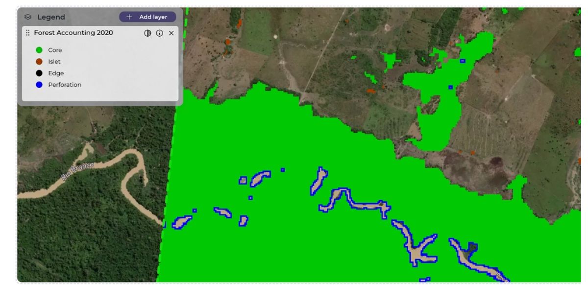
- Forest attributes
This dataset categorizes forest patches by size, aiding in identifying higher-risk or more fragmented forests. It can contribute to assessing 'forest condition', a metric useful beyond European Union Deforestation Regulation (EUDR) purposes.
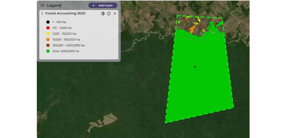
The forest pattern layer and statistics in this dataset reveal morphological features of forest pixels, including up to 25 unique classes that describe forest patterns, connectivity, and the area of openings within forests. This provides an additional attribute for assessing forest condition, useful not only for EUDR compliance but also for broader forest condition assessment and risk analysis.
- Global map of forest cover (2020)