Last edited: August 18, 2023
Published: August 18, 2023

Orbify
Earth Intelligence Specialists
Blog Post
Last edited: August 18, 2023
Published: August 18, 2023
Orbify
Earth Intelligence Specialists
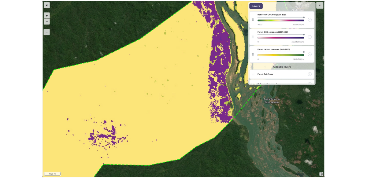
The greenhouse gas monitoring feature is now accessible within the application, providing our users with the capability to estimate emissions and removals of tCO2/ha within their monitored forest area.
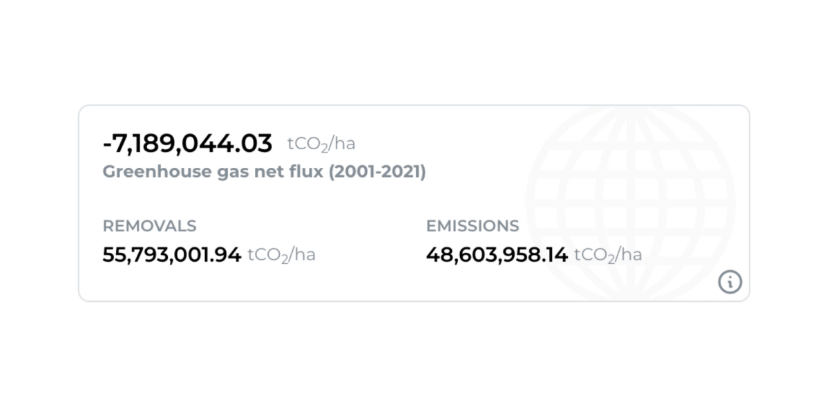
Additionally - all the layers are shown on map for easy visual inspection.
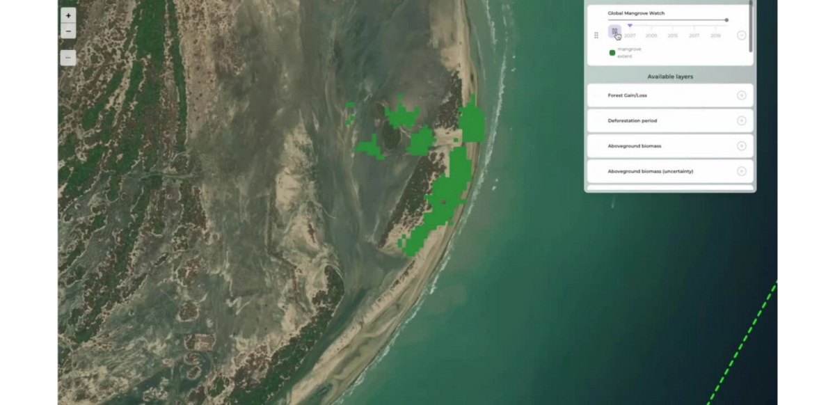
Based on the Global Mangrove Watch dataset, we have introduced a new capability that allows you to monitor the extent of mangroves within your project area.
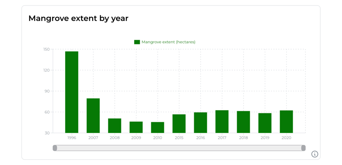
The mangrove map layer allows you to visualize changes in extent over time.
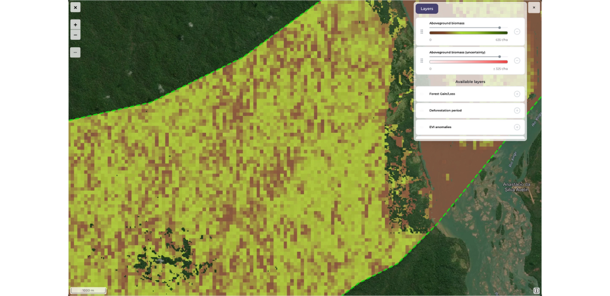
The above ground biomass calculations can now be switched to use the updated AGB dataset (v4.0)
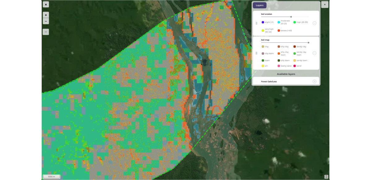
Our latest update introduces a set of indicators for monitoring soil quality
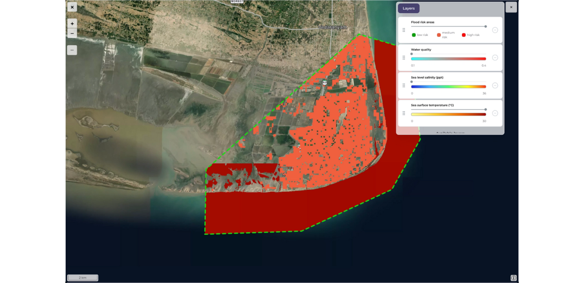
We’ve also added a set of indicators for monitoring water quality:
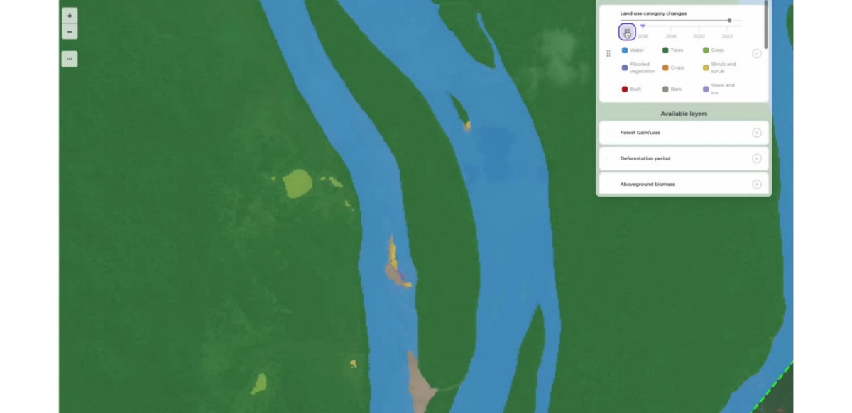
The land use categories indicator was updated with a layer allowing to view land cover changes over time.