Streamlining Illegal Housing Detection in Urban Sprawl Analysis
By partnering with Orbify, Vasundharaa Geo Technologies simplified the delivery of their urban sprawl analysis solution.


CUSTOMER
Vasundharaa Geo Technologies is a specialized remote sensing company that offers geospatial solutions for agriculture, defense, and civil government sectors. The company leverages machine learning algorithms to create an advanced analytics layer over Earth Observation data, enabling pattern recognition, image segmentation and object detection.
PROBLEM
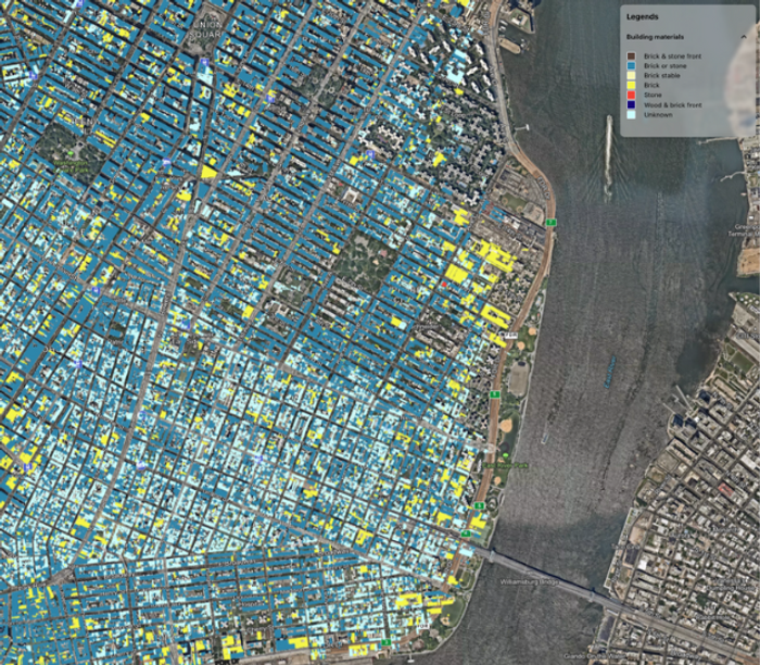
As a developer and provider of AI engines, Vasundharaa faces the challenge of delivering their products down the value chain, to end-users. Navigating this complex value chain becomes particularly challenging due to the diverse set of requirements from their customers and a lengthy and costly development process. Vasundharaa set out to develop an innovative system for detecting urban changes in the Mumbai Metropolitan Region using one of their proprietary algorithms; the solution was intended to be used by the Municipality office to analyze the impact of urbanization on nearby forest areas and the impact of urban sprawl on local ecosystems. They knew they needed to streamline the access to the data to final users without putting a strain on their engineering team.
SOLUTION
To address this, Vasundharaa partnered with Orbify to build out a comprehensive solution for one of their flagship models. The partnership enabled Vasundharaa to scale their operations without putting additional strain on their internal R&D team, allowing them to focus on their key areas of expertise.
The collaboration between Orbify and Vasundharaa produced a clever solution that uses machine learning algorithms to analyze massive volumes of cadastral GIS data and satellite imagery to detect and monitor urban changes in the Mumbai Metropolitan Region. The system also has strong data processing capabilities that turn unprocessed satellite data into data analysis that is ready for use and gives decision-makers insightful information.
RESULT
An essential part of the solution, the interactive dashboard provides customers with an easy-to-use interface for accessing and visualizing the studied data. It offers sophisticated reporting tools that let customers create reports and visuals that are tailored to their particular needs. The dashboard is an effective tool for well-informed decision-making since it encourages collaboration and data sharing among many stakeholders.


