PlanT Reforestation + Orbify: Scaling Forest Carbon Monitoring and Ecosystem Stewardship in Colombia
Working with Orbfiy allowed PlanT to save 50% in field costs, validate 658 ha of forest and agroforestry cover and to develop their own high-integrity monitoring model.
Introduction to PlanT
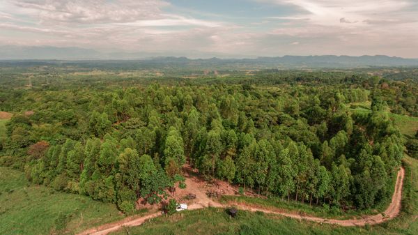
PlanT Reforestation, the environmental arm of a Colombian cacao-exporting group called Colcocoa, is reshaping the way ecosystem services are measured and monetized across agroforestry landscapes. Supported by international corporations, PlanT is working closely with rural families to reward local ecological stewardship but through corporate investments. This way of generating additional revenue streams for local communities involved in cocoa production serves as an alternative financing mechanism.
To realize this vision at scale, PlanT needed to develop a robust, high-integrity monitoring model built on trust, technology, and local livelihoods. This meant evolving from plot-by-plot field measurements to a tech-enabled monitoring model — one that could rapidly analyze forest and cacao cover for carbon storage and ecological value without overextending budget or personnel.
That’s where Orbify came in.
The Challenge: Time-Intensive, High-Cost Carbon Monitoring
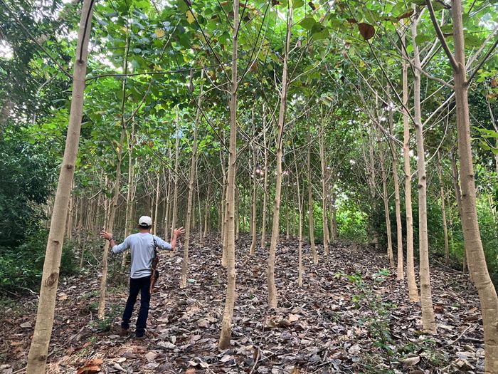
Until recently, PlanT relied on in-field sampling to collect critical data like tree species, height, and diameter, using this information to manually calculate carbon storage. While scientifically rigorous, the process was costly and slow.
“Visiting a single farm could cost between $200 and $600. With 320 farms in our project population, this method simply wasn’t scalable,” said Juliana Moreno Vodniza, PlanT’s Project Director.
Initial efforts to incorporate satellite imagery independently revealed further limitations: the learning curve was steep, data downloads were time-consuming, and processing pipelines complex.
The Solution: Seamless Monitoring with Orbify
PlanT integrated its software with Orbify’s platform via our API to fast-track their algorithm development for forest and carbon monitoring.
Orbify’s spectral bands, masking tools, and forest integrity indexes became foundational inputs for PlanT’s machine learning models — offering field-ready insights with a fraction of the effort.
“With Orbify, we could analyze dozens of farms in the time it would have taken us to process just one manually. The platform gave us data that was ready to use — no heavy downloads, no cleanup,” said Juliana.
Rather than replacing fieldwork entirely, PlanT now uses Orbify to scale beyond samples, extending insights to the full population of 320 farms. In their latest phase, 160 farms were visited in-person, while the remaining were monitored using Orbify’s satellite-based analysis — reducing fieldwork by half and saving tens of thousands of USDs in operational costs.
Results: From Carbon to Connectivity, with Trust and Traceability
Orbify has allowed PlanT to:
- Accelerate carbon model development with AI-driven remote sensing inputs
- Save up to 50% in field costs, equivalent to $30,000 – $90,000 in a single project phase
- Reduce time to monitor farms from 6 months to a couple of days — on site visits for 160 farms would take 6 months. With Orbify, just a few days were needed.
- Add ecological value metrics like forest integrity and agroforestry connectivity
- Lay the groundwork for a high-integrity monitoring framework
- Create reliable, science-based datasets that guide long-term conservation strategies and de-risk nature-based investments.
- Enhance credibility by serving as a trusted tech partner
- Validate base line data: 658 ha of high-integrity forest and agroforestry cover
- 373 ha linked to water sources with ecological value
- 194 ha under active or passive restoration
What’s next? PlanT is expanding its model to include biodiversity (via bioacoustics), water conservation, and connectivity metrics — creating a multi-dimensional monitoring system backed by Orbify’s ongoing support.
Why Orbify?
PlanT Reforestation chose Orbify for its seamless API access, which allowed them to extract and process geospatial data quickly — crucial for building deforestation monitoring models under tight timelines. Here is why they saw an ideal partner in Orbify for a mission-driven startup navigating complex forest and crop carbon and land-use monitoring.
- Developer-ready API for fast data access and integration
- User-friendly satellite platform with pre-processed analytics
- Flexible pricing suited to early-stage climate tech
- Collaborative support team ready to troubleshoot and co-create
“Orbify helped us move faster, with more confidence. Its data made it possible to scale without sacrificing scientific rigor — and Orbify was there for us every step of the way.” — Juliana, PlanT
“At PlanT Reforestation, we are building high-tech, nature-positive solutions to monitor carbon capture and ecosystem services across agricultural landscapes in Colombia. Integrating Orbify’s satellite capabilities has allowed us to bring cutting-edge technologies into the field—linking remote sensing with community-based conservation in a meaningful way. Their forest integrity and land-use indexes have helped us establish reliable baseline data, and their platform is now central to the development of our predictive carbon capture model. What sets Orbify apart is their highly responsive, almost tailor-made service. Their technical team actively supports our modelling work and continuously follows up on our inquiries, making sure we’re always on track. For a mission-driven startup like ours, Orbify is more than a data provider—they’re a strategic partner driving transparency, trust, and impact” – Juliana, PlanT
Looking Ahead: Building a Model Others Can Follow
PlanT’s approach challenges the norms of carbon finance by building robust, transparent systems rooted in community participation and ecological integrity. With Orbify as a trusted partner, they’re proving that forest monitoring can be scalable, science-based, and equitable.
Want to see Orbify in action?
Schedule a free consultation with our experts today


