Last edited: November 21, 2023
Published: November 20, 2023

Orbify
Earth Intelligence Specialists
Blog Post
Last edited: November 21, 2023
Published: November 20, 2023
Orbify
Earth Intelligence Specialists
In a world increasingly concerned about environmental conservation and climate change, evaluating the quality and authenticity of sustainability projects is of paramount importance. While there's a growing need for projects that mitigate climate change, it's equally vital to analyse the claims they make. This article explores the role of remote sensing in assessing project claims and highlights its significance in ensuring high climate integrity.
Before we delve into the role of remote sensing, let's understand what project claims entail. When evaluating a project's claims, it's crucial to assess whether it accomplishes real, measurable, additional, and permanent changes that significantly contribute to climate integrity.
Project claims are not without challenges. Several issues, including geographic leakage and non-permanence, can undermine the effectiveness of climate offset projects:
When assessing a project, it's essential to scrutinize the project area, baseline calculations, and indicators of quality:
Assessing project claims can be a complex task, as project descriptions are often lengthy and intricate. It's crucial to perform due diligence to determine if project claims are likely, but it's equally important to avoid oversimplification.
There are many methodologies for assessing project claims, and most of them share similar concepts. Fortunately, remote sensing data can be a valuable tool in this process, providing extensive literature for reference and offering customizable risk maps.
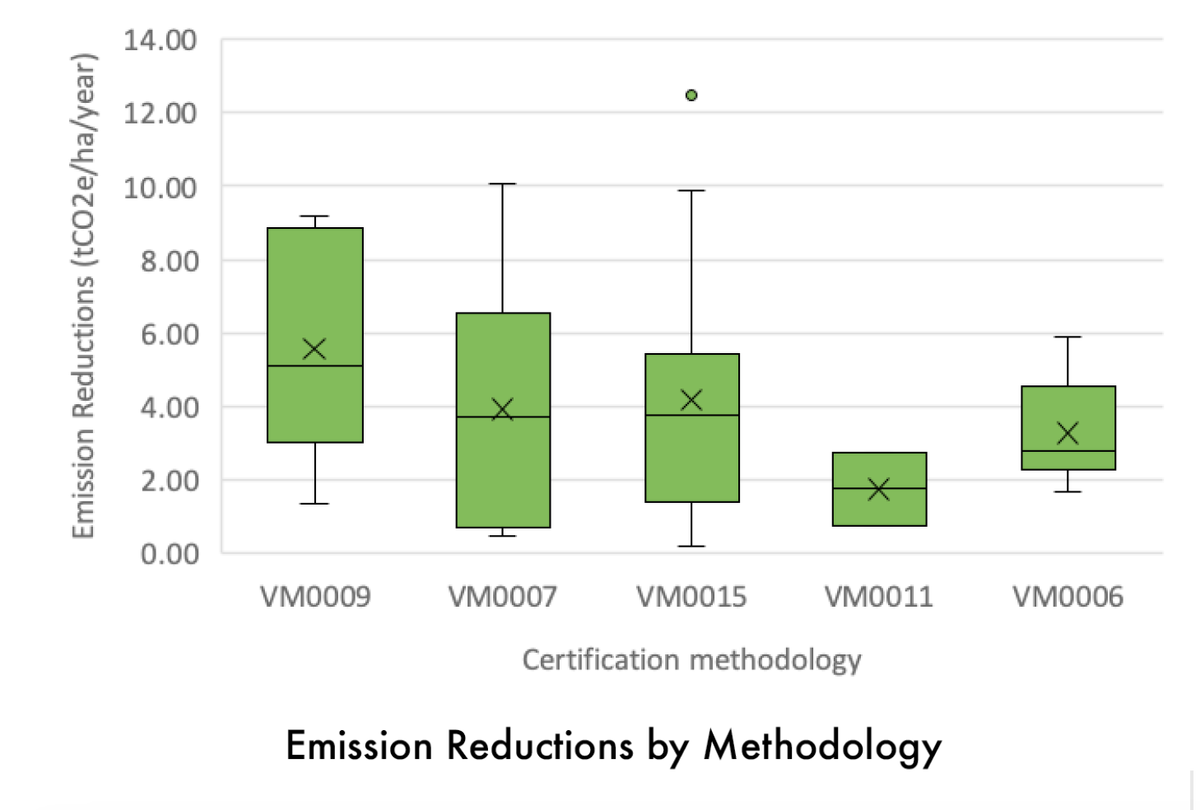
When evaluating REDD+ projects (Reducing Emissions from Deforestation and Forest Degradation), several factors should be considered:
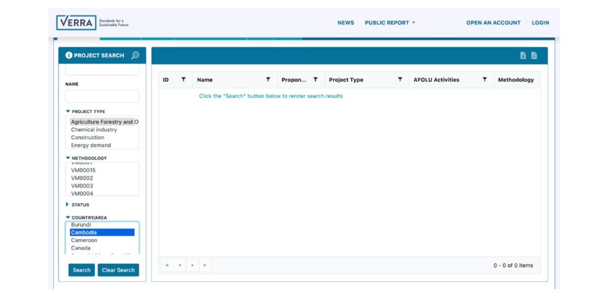
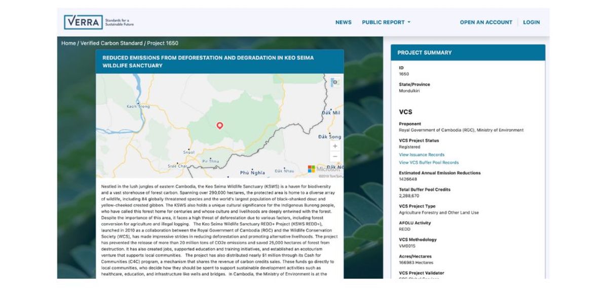
To review a project, you can use the Verra registry, where you can access digital files representing project boundaries. However, be aware that not all projects provide the actual project area, reference region, or leakage area. In some cases, you might need GIS tools to generate these areas.
You can gain further insights into projects by creating customizable risk maps, considering factors like proximity to deforestation fronts, population centers, rivers, roads, and topography-based accessibility.
You can check here our latest Orbify Review, which is a blog article series where we pick an NbS project related to the Voluntary Carbon Market and review it using our Geospatial Data Platform (GDP) to show how can people use and take advantage of our platform to analyse a VCM project or even to monitor and use the data to include in your PDD on the project development.
Orbify offers a range of tools and services to enhance project assessment and monitoring, including:
Assessing project claims with remote sensing can play a pivotal role in ensuring that the projects we invest in are making a meaningful contribution to the environment. By embracing advanced technology and methodologies, we can help protect our planet and combat the challenges of climate change more effectively.