Last edited: July 10, 2023
Published: June 28, 2022

Daniel O'Donohue
MapScaping Podcast Host
Blog Post
Last edited: July 10, 2023
Published: June 28, 2022
Daniel O'Donohue
MapScaping Podcast Host
By the end of 2011, the world’s governments and militaries had deployed 30 Earth observation/remote sensing (EO/RS). Those were the only EO/RS satellites deployed during that year and they collected optical imagery or weather data. By contrast, nearly 200 EO/RS satellites were deployed during 2021, the majority of them operated by commercial companies. About half of those satellites collect optical imagery, however, the remainder also collect geospatial data using synthetic aperture radar (SAR), infrared, and radio frequency (RF) technologies. The EO/RS space world has changed during the last decade and may change even further as new startups see opportunities and attempt to seize them.
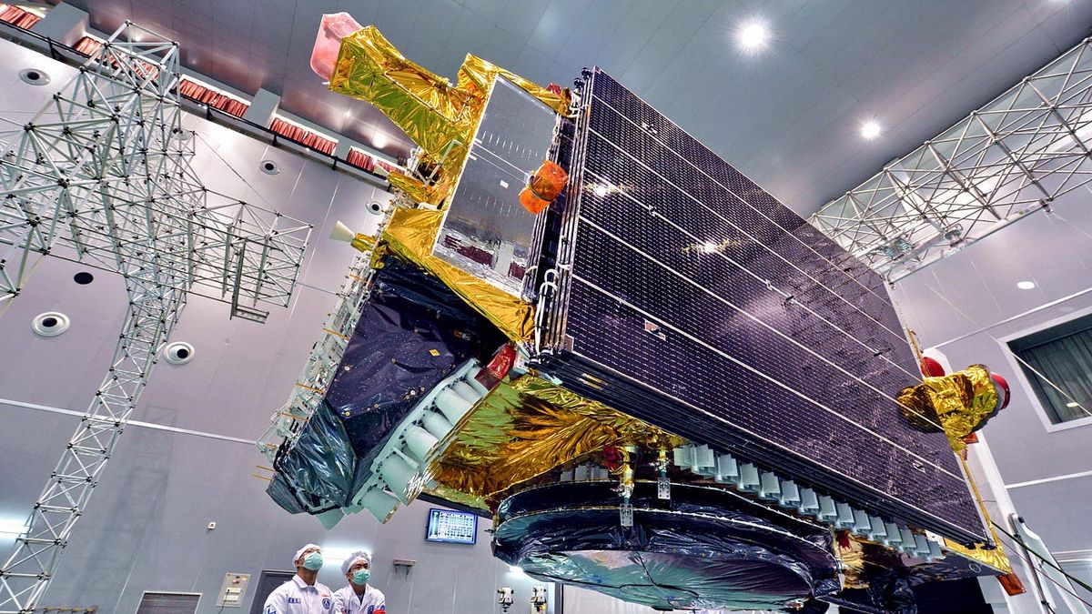
As noted above, government and military organizations operated all EO/RS satellites deployed in 2011. They operated most of the EO/RS satellites deployed during the decades leading up to 2011. During that time, obtaining high resolution imagery from spacecraft required approaching government entities worried about national security and classified information. They also juggled the time availability to take pictures of certain areas of interest on the Earth because of limited numbers of high-resolution satellites and an even smaller number of ground stations. The satellites themselves were expensive, which reinforced keeping national Earth observation satellite constellations small. Low revisit rates with limited satellites meant that collecting a single image of a desired area might take days or weeks.
Those limitations were and are driven by both security concerns and the limited availability of spacecraft. Satellite availability seems to be in a very different place ten years later, as the large numbers of satellites deployed addresses a few of those EO/RS limitations. Moreover, many changes are occurring because of WHO is operating those satellites. A few years after 2011, commercial startups began operating EO/RS satellites. To be clear, other commercial EO/RS companies existed alongside the government companies, but they tended to mimic in number and process, their government customers. They offered imagery products and faced the same limitations their government counterparts did. That began to change during the last decade.
Small Satellites Driving Changes
In 2013, a single Dove 2 satellite was deployed from a Soyuz 2–1A rocket for a U.S. company (Cosmogia, which ultimately changed its name to Planet). A single EO/RS CubeSat isn’t much, however near the beginning of 2014, 33 of the company’s satellites were transported to the International Space Station (ISS). The ISS would eventually deploy those satellites into a low Earth orbit. That same year, a Russian Dnepr rocket launched 11 CubeSats for Planet. It was a record-breaking launch since the rocket deployed not just Planet’s CubeSats, but 26 other satellites as well. Even though the company’s CubeSats were very small, it was the first year that a commercial company’s satellite deployments beat out those of governments and militaries. By 2019, the company stated it was in charge of the world’s largest fleet of satellites.
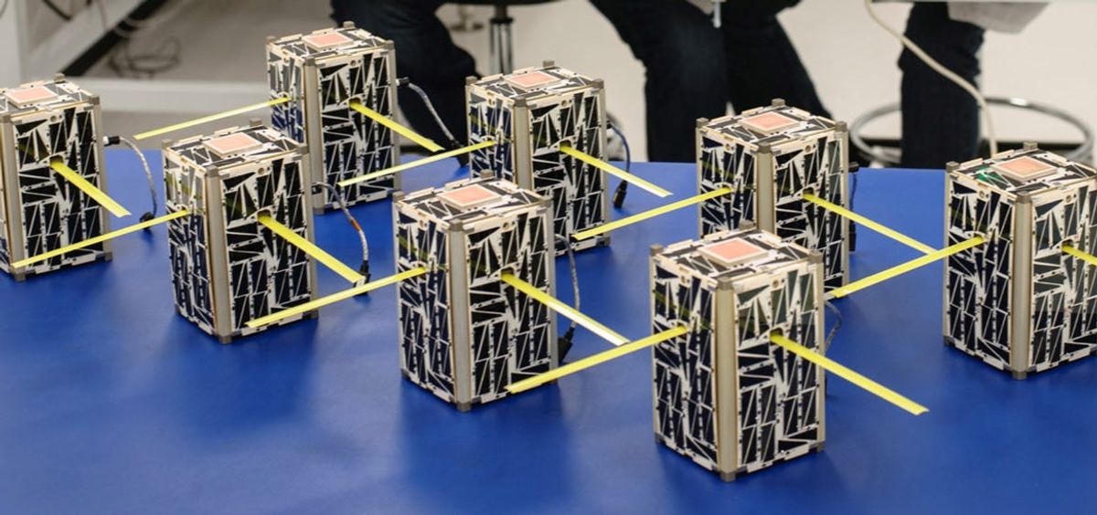
Other startups have joined in on the geospatial satellite business, each advertising a distinguishing factor or technology (maybe both) as an attempt to stand out from the other EO/RS companies. All of their efforts add up to a 500+% increase in the number of remote sensing satellites deployed in 2021 vs. those deployed in 2011. Unlike the 2011 EO/RS satellites, most of the commercially run satellites deployed in 2021 are small and less expensive. The relatively low costs provide startups flexibility in determining how many satellites are necessary to accomplish a particular goal and then implement the plan without compromising those numbers.
Smallsat form factors also provide EO/RS satellite operators flexibility for choosing when to launch and who to launch with. Small satellites, specifically cubesats, have a shape and interface all rocket launch service providers can work with. Planet, again, is the example, as it first deployed a satellite from a Russian rocket, then more later from the ISS, and even more quite a few times from India’s Polar Satellite Launch Vehicle (PSLV). Planet continues to launch its satellites using rockets from several launch providers.
Product Proliferation
The strengths of these characteristics, and the companies rapidly adopting to build and service smallsats, are evident in the many EO/RS smallsats that have been deployed during the last decade: over 600. The increasing numbers of EO/RS spacecraft should provide more opportunities to collect imagery from a specific area. It also implies that a company’s satellites will pass over that area in a matter of minutes or hours, rather than days or weeks. Another result, however, is the proliferation of different types of EO/RS products from these new commercial startups.
Some companies are entering other parts of the EO/RS business instead of pursuing optical imagery. As noted earlier, startups are constantly in search of that “killer app” — the thing that will make them special and profitable. In this case, they are exploring EO/RS products that others have neglected or ignored. Such searching results in the development and deployment of satellites with infrared, SAR, and RF detection capabilities. SAR for example supported the domain of defense or civil requirements for decades. There were zero SAR commercial satellites in 2011. However, by the end of 2021, that number increased to 41. There are similar increases in commercial RF detection satellites. And more startups are planning to implement their particular flavor of space-originated EO/RS products.

Given the increased numbers of those startups, some will succeed.
To be clear, each of these EO/RS operators has a plan to offer a product for sale and the good news is there continues to be more products from these companies than ever were available even to governments back in 2011. But it seems also clear that each increase of products in the geospatial market will require those searching for products to already know what company is producing a specific product type. Such diversity can be daunting to even the most ambitious entrepreneurs seeking to use the data from these companies in ways not anticipated.
For those seeking to become familiar with what’s available in the diverse EO/RS datasets and their sources, or just seeking for ideas inspired through combining the data into other products, that’s where startups like Orbify come in. They seek to make finding and using EO/RS products simple and offer products from multiple space EO/RS sources. The larger their data libraries become (which may be a likely path considering the increases in EO/RS companies and satellites) the more data that becomes available to anyone interested in using it.
All of the current startups, their smallsats, and the resultant products, result from less than a decade’s worth of commercial innovation and change that bridges across multiple technologies. While the changes are unprecedented in the EO/RS commercial space, it is likely that the current state of it will change again as more startups enter it. There will be more EO/RS satellite operators deploying more smallsats, which will increase the products available to consumers.