Satellite Infrared Data and Crop Health
Last edited: July 10, 2023
Published: July 11, 2022

John Holst
Space Industry Researcher
BLOG POST
Last edited: July 10, 2023
Published: July 11, 2022
John Holst
Space Industry Researcher
https://www.xyht.com/enviroag/satellite-imagery-precision-agriculture/
Drought and crop health have been concerns for governments and farmers since farmers started growing crops. As a result, farmers keep a close watch on their fields, attempting to catch problems before they occur. Likewise, governments want to understand how much the farmers will produce each year — before their crops are grown.
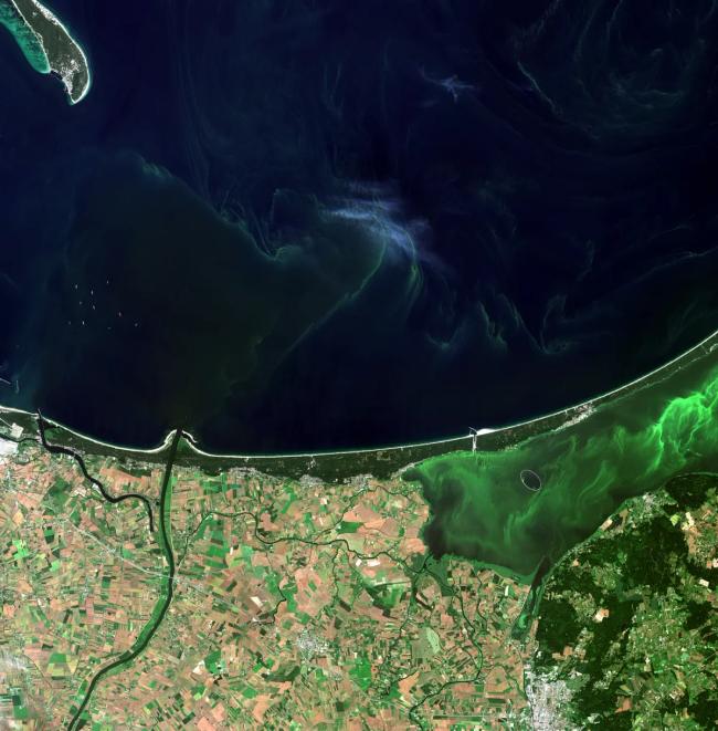
The latter attempt, currently encapsulated in crop production forecasts, is why some nations use satellites. For example, Europe fielded its Copernicus remote sensing (RS) constellation while the United States launched its Landsat series of satellites. Those satellites use a host of sensors to collect information for managing the natural resources available on the Earth. Their sensors focus on parts of the spectrum from visible through infrared to determine the lay of the land. To this day, satellite infrared sensors provide helpful information to governments interested in crop forecasts.
Infrared data is available to farmers as the satellites’ agencies produce reports and analyses of their observations. But their reports cover large areas of the Earth, not a farmer’s specific corn or soybean field. A farmer might get lucky and find images that include the farmer’s land, but the report’s data is a generic account of the area in which that farm is located. The agencies generating these reports also tend to be a little — slow — in publishing the reports. As a result, farmers may use these reports but also have more immediate and basic needs, such as determining if an entire crop is getting enough water and fertilizer.
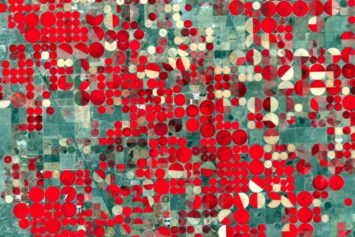
Determining whether either is occurring is why more immediate access to infrared data could be helpful to farmers. Infrared is a common spectral band that satellite Earth observation (EO) operators use to determine the existence of vegetation and how healthy it is. The brighter the “red” the vegetation reflects to the sensor, the healthier it is. Infrared simplifies a satellite operator’s determination of whether the areas they observe have vegetation. For governments curious about the overall health of crops within their boundaries, images overlaid with infrared data provide reassurance and help inform their land-use plans to preserve green spaces best.
People routinely use infrared on Earth, whether for measuring a person’s temperature or determining a storm’s energy. It’s an available setting on several smartphone cameras. It can also inform a farmer when a plant needs water before it physically shows the deterioration caused by dehydration (its water stress level). Determining which plants aren’t receiving as much water in a field of plants can help farmers decide if there’s an irrigation problem and how to fix it.
People interested in understanding and using the technology on a plant-by-plant level can access sites containing instructions for inexpensive camera modifications. Those mods provide an infrared look at plants — one or a few at a time. But for farmers interested in the overall health of a crop, that route is too tedious and time-consuming.
There are alternatives to that single modified camera. The most obvious may be infrared data provided by drone or aircraft operators. But for either data collection method, data may be unavailable in certain land areas, such as those with flight restrictions. They also are time- and resource-intensive, as daily, weekly, or monthly monitoring flights are required to help farmers catch potential crop challenges before they occur. A less obvious problem may be the potential lock-in to those services and their lack of comprehensive, older imagery data libraries (useful for comparisons).
As hinted at the beginning of this article, another alternative is the infrared data provided from satellites, particularly from government-operated remote sensing infrared satellites. Government-operated satellites have decades of imagery to comb through. Farms within the field of view of one of those satellites may have had their entire crops imaged, resulting in valuable infrared data about crop health. To be clear, that data required mere seconds to obtain through a relatively automated scheduling process, just like you can try in this Environment Monitoring Platform. Because of that process and the long history of these government programs, it may be that more than one image of their crops exists, depending on a farm’s location.
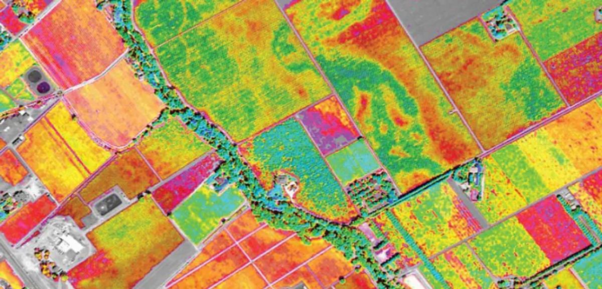
The satellite-obtained infrared data will likely have the entire crop in a single image frame. As a result, the infrared data can highlight spots in a crop requiring attention. Infrared imagery can also show if a lack of water is part of the crop’s problem. That information, in turn, can help farmers determine if an entire crop area needs its irrigation augmented or to focus those augmentations on a smaller area. With access to a potential depth of older images, farmers can determine if the problem is relatively new (and the changes that may have caused it) or understand that the problem has been around for a while.
However, these use cases return to the original problem farmers face with satellite data: customized and targeted looks at their crops. Farmers are some of the busiest people on the planet and would likely prefer not to obtain the skills necessary to become an EO/RS infrared analyst. However, some options allow them to see if the overhead infrared data is useful in their cases without them becoming infrared specialists. Some of the data from those satellites are available from startup EO/RS companies such as Orbify. Data within those libraries may allow a farmer — or better, a farmer’s consultant — to customize it by targeting specific areas and observing their changes over time.
Libraries like that will likely become more comprehensive and of higher quality as governments build and deploy new satellites to collect more infrared information about the Earth below. That improvement will only help with crop health monitoring in the future. Whether infrared or green, the future looks bright for crop health.
6 mins read
November 20, 2023
10 mins read
October 4, 2022
8 mins read
August 17, 2022