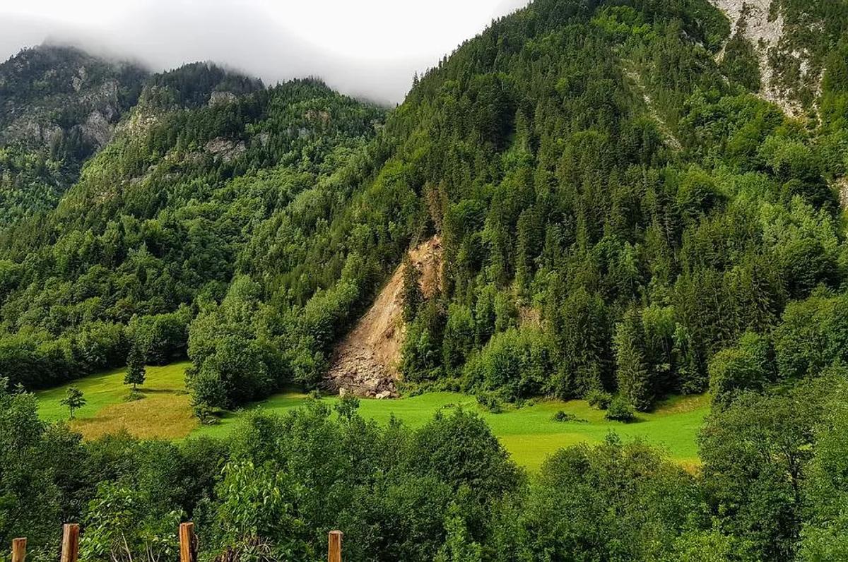
Landslide is a geological hazard that has the potential to trigger a disaster by either natural or anthropogenic changes induced in the environment.
Some of the most common causes that can result in a landslide include: the fragility of the rock and soil formation, high level of precipitation, erosion, alteration of slope via agricultural practices such as terrace farming, deforestation, and mining activities.
Landslides are considered one of the most devastating natural hazards that are essentially geological in nature but a number of factors contribute to the activation of a disastrous event on a massive scale. For this reason, the real-time monitoring of landslide-prone areas is essential for the mitigation and prevention of a potential disaster.
With the advancement in geospatial technology and the rapidly increasing use of sensor-based technology for early warning and landslide monitoring, the potential losses can be minimized with every-day available tools, such as Orbify. Another more specifi tool could be aWireless Sensor Network (WSN). This one has receptor sensors that are connected in a network to wireless nodes. The receptive sensors monitor the movement of soil and other associated geological factors in the landslide-prone area, the value is then compared to a predetermined threshold value. If the received values exceed that of the threshold, the relay station sends out a warning alert warning and impending landslide occurrence in the area.
The high spatial and temporal resolution satellite remote sensing data can be exploited to derive information regarding the geological conditions of an area in addition to the movement of the slope that can result in a landslide. A number of research projects based in Europe are focusing on the development of techniques and tools that aim at improving the response time after a landslide occurs. This is mainly done by providing mapping services before, during, and after a landslide event. One such project is SAFER (Services and Applications for Emergency Response) under the 7th Framework Programme (FP7) — SPACE Theme, funded by the European Commission. The focus of the project was to provide support in the management of geophysical hazards including landslides, volcanic eruptions, and earthquakes as well as for humanitarian crises.
The project aimed at implementing the Emergency Response Service of the Copernicus, previously called the European Global Monitoring for Environment and Security (GMES), under the European Earth Observation Programme. During the preparedness phase, the mitigation measures, recovery, and rehabilitation operations, the program provided rapid mapping and monitoring services by using the latest satellite imagery of the landslide hazard-prone and affected areas by combining them with the pre-existing reference maps. The landslide hazard maps were then delivered to the decision-makers and planners in the national, regional, and local departments working within the field of disaster management and early warning dissemination.
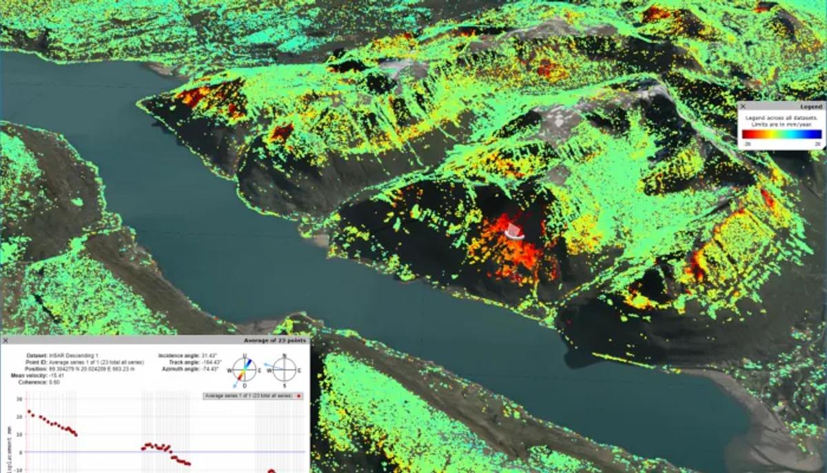
Fig.1. Screenshot from insar.ngu.no that shows, for each coloured point, its mean movement (in mm/y) and the time series of its displacement.
Another important product used for rapid landslide monitoring is the Synthetic Aperture Radar (SAR) which has the provisions of cloud free imagery, and day-and-night observation, and has a wide swath providing coverage over a large area. The Interferometric SAR (InSAR) is frequently used for rapid monitoring of landslides however, the same process is difficult in a mountainous region with thick forest cover owing to significant decorrelation. A combination of InSAR, Digital Elevation Model (DEM), and Polarimetric SAR (PolSAR) is also used for the detection of landslides induced due to heavy precipitation in a hazard-prone area. The assessment accuracy with these products is highly dependent upon the geological parameters of the study area.
Moosfluh Slope Instability
In the last few years, the use of Unmanned Aerial Vehicles (UAVs) is rapidly becoming frequent with the readily available digital cameras that are light weight. The digital cameras have enabled the UAV-systems to work as practical and affordable image capturing platforms. This arrangement allows for high resolution imagery to be captured and used with ease depending upon the need of the assessment. The UAV based remote sensing images are utilized for generation of Digital Terrain Model (DTM) and ortho-mosaic which are useful products in landslide monitoring process. Remote monitoring sensors are also frequently employed to determine the characteristics of landslide and its monitoring. Technologies such as the LiDAR and photogrammetry has the potential to play a key role in rock slope assessment in addition to Acoustic Sensing, ArcSAR Interferometry and Gigapixel imaging which have shown limited applicability in landslide monitoring.
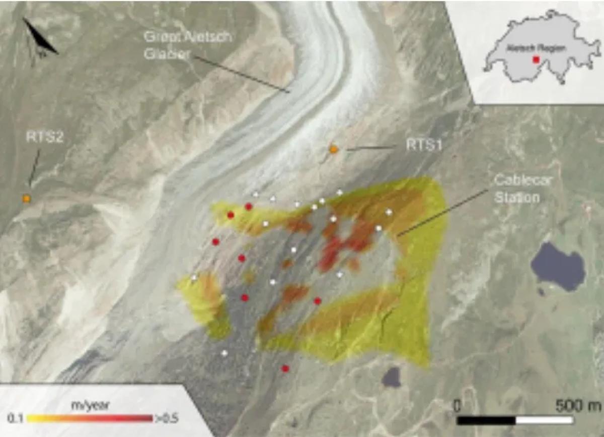
The United States Geological Survey (USGS) has its fully operational near real-time hillslope stations for hydrologic monitoring. The system has been used across the country for over a decade with the aim that it will eventually serve as the foundation for establishment of an early warning system for potential debris flows. The stations set up under this program continuously monitor the rainfall and track the movement and quantity of water in the upper regions of a hilly area. Instruments for detection of ground movement are also installed. The data gathered helps in determining the probability of occurrence of a landslide event and aid in the development preparedness activities and plans by concerned organizations. The European Space Agency`s Geohazards Exploitation Platform or GEP2investigated the Moosfluh slope instability via the radar images generated from Copernicus Sentinel-1 Satellite Mission in late 2016 by producing the velocity maps of the unstable slope (Figure 1). The slope was being observed via ground based instruments installed in 2013 by the Chair of Engineering Geology at the Swiss Federal Institute of Technology in Zurich (ETHZ).
Landslides are dynamic geophysical hazards that triggers into a disastrous event as a result of several different parameters cumulating overdue to certain natural and anthropogenic factors. With the advancement in the development of real-time sensor networks and the availability of satellite-based remote sensing imagery, the monitoring of large areas is increasingly becoming possible with high accuracy data products. A robust monitoring system based on the state of the art geospatial technology enables the decision-makers to equip themselves with plans and tools required to counter any potential disaster event and minimize the adverse impact on lives and infrastructure.
If you would like to create your own app to monitor landslides and learn more about Earth Observation apps, visit Orbify.
References