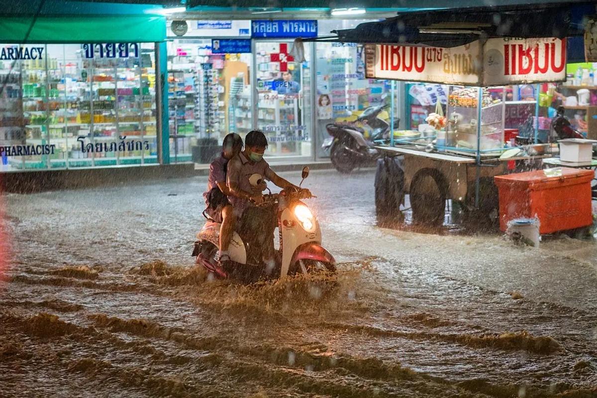
Floodings are dangerous when not prepared
Floods are one of the most frequently recurring phenomena around the globe, the frequency is now being amplified because of climate change.
The devastating impact of floods poses a threat to life and infrastructure, particularly in the absence of an early warning system and increased vulnerability of communities. Aside from frequency, the nature of floods can determine the extent of damage caused and mitigation measures required.
Riverine flooding and flash floods have their unique dynamics; however, urban flooding has significant potential to damage the infrastructure and cause environmental degradation.
Flood risk modelling essentially provides a holistic picture of the potential threat posed by an imminent flooding event. It takes into account the historical flood data, precipitation records, characteristics of the riverbed and other hydraulic and hydrological factors that contribute to the magnitude of risk posed by floods. Geospatial technology and GIS-based tools (like Orbify) and techniques play an important role in flood risk modelling. Satellite remote sensing is one of the most powerful instruments available for flood mapping, as it provides coverage over a vast area and the temporal resolution allows for assessment over a shorter period of time.
The availability of satellite imagery, particular in the event of a disaster in recent years has increased the ease of flood mapping in terms of frequency. This has also allowed the experts and general users to acquire free data at a comparatively lower cost.
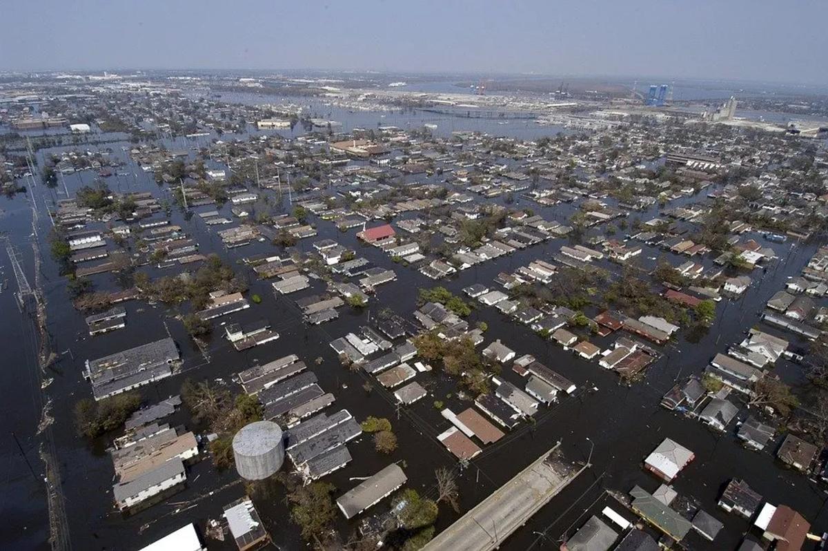
New Orleans Louisiana After Hurricane Katrina City
The development of semi-automatic methods for flood mapping enables the general community involved in flood hazard management to perform the assessment without acquiring extensive technical expertise in the field.
The availability of satellite remote sensing data over a wide range of spatial and temporal resolutions, including the multispectral satellite data such
as Landsat, MODIS, Synthetic Aperture Radar (SAR) data acquired by Sentinel-1 and the currently used Sentinel-2 have paved the way for innovation and advancement in flood modelling. Aside from these products, the free ancillary data including the Digital Elevation Model (DEM), Digital Terrain Model (DTM) and Digital Surface Model (DSM) also find their utility in flood hazard mapping.
The advantage of using Synthetic Aperture Radar (SAR) is the ability
of the satellite, sensor to penetrate through the cloud cover and capture imagery via microwaves. This enables the determination of the actual extent of the flood and helps identify the inundated locations. The results produced by applying indices to the satellite remote sensing products are validated via ground truth data to ascertain the accuracy. You can try some of the SAR functionalities with Orbify.
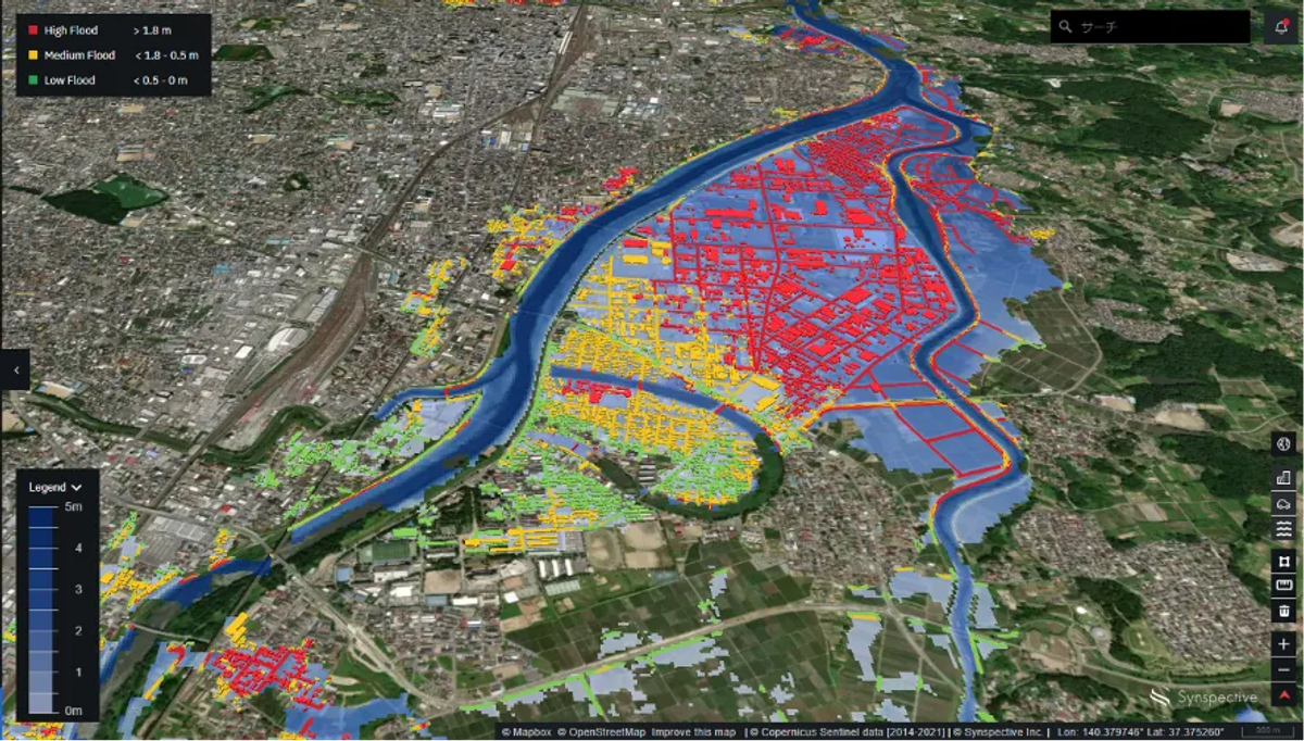
Synthetic Aperture Radar Satellite Imagery for Flood Damage Relief
Geospatial technology has the ability to integrate both spatial and non-spatial data which makes it a dynamic entity for any kind of assessment, particularly flood modelling. The reason is that flood is a phenomenon that occurs as a consequence of meteorological, hydrological, topographical and anthropogenic factors combined together. Thus, the technology provides products and platforms for the assessment process which combines a large quantity of statistical, spatial and survey-based data. Commercial software like ArcGIS and open-source platforms including QGIS has the provision to develop the geometric data for flood inundation modelling. HEC-GeoRAS, an extension can be embedded within the ArcGIS environment in order to prepare geometric data or a 1D model of a river system, which is later
processed within the HEC-RAS environment.
The mapping of the hydrodynamic model is essential in flood modelling as it enables the determination of inundated areas. The identification of inundated areas aid in real-time decision making for rescue and relief operations in the event of a disaster, proposing mitigation measures to minimize the impact of future flood occurrences and also to evaluate the quality and accuracy of the results presented by the model. Aside from the models and available software out there, innovative means of flood modelling are also available for assessment.
The World Flood Mapping Tool is one such initiative by the Institute of Water, Environment and Health at the United Nations University that aims at addressing the data gaps and shortages and make the best possible use of the available data in countries where spatial data is not readily available.
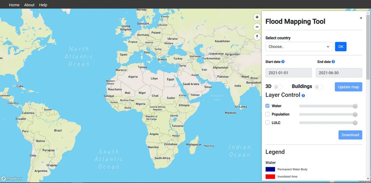
World Flood Mapping Tool
The Tool has been created in collaboration with Mapbox and Google and has the provision of ease of downloading flood mapping data. The tool has high level of accuracy as demonstrated by its usage in the 2017 flood in Bangladesh:
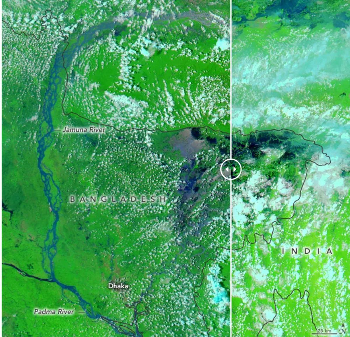
Bangladesh LIVE comparision tool
Flood preparedness is one of the crucial factors related to flood modelling. Innovative geospatial technologies are now focusing on the development of tools that can accurately estimate the depth of historical floods by assessment of aerial photographs and satellite images. These tools make use of deep neural network algorithms to estimate the depth of previous flood events in order to generate reference points for potential future flood occurrences and aid in preparedness.
One of the leading agencies working in the realm of flood modelling is the United States Geological Survey (USGS). Under its National Geospatial Program, the country has taken up the mission to provide topographic data for helping the researchers, government and citizens in equipping themselves with the necessary tools and knowledge related to flood modelling and early warning. In addition, the National Hydrography Dataset (NHD) is also managed under the USGS National Geospatial Program. Other datasets include the NHDPlus High Resolution (NHDPlus HR) and Watershed Boundary Dataset (WBD); these geospatial datasets are being used for the representation of surface water conditions of the country for the purpose of modelling and flood extent mapping.
Geospatial technology has essentially played a significant role in equipping the researchers, government agencies and public in using the spatial data products for specific purposes related to flood early warning, preparedness, rescue and relief operations in the event of a disaster, in addition to adopting suitable mitigation and adaptive measures. The availability of free satellite remote sensing data, its temporal resolution, the commercial and open-source tools and software that are available for exploring various aspects of flood
modelling has helped in developing robust real-time early warning systems, and risk-sensitive preparedness plans and paved the way for further innovation within the field.
References
1. https://www.usgs.gov/
2. https://www.gislounge.com/