Last edited: November 8, 2023
Published: November 8, 2023

Orbify
Earth Intelligence Specialists
Blog Post
Last edited: November 8, 2023
Published: November 8, 2023
Orbify
Earth Intelligence Specialists
The need for effective and reliable tools for assessing and monitoring the environment has never been greater. Remote Sensing (RS) through satellite technology is emerging as a key solution for addressing challenges related to origination, verification, and due diligence in environmental projects. In this article, we will explore the benefits, limitations, and potential applications of satellite data, as well as the role of machine learning and deep learning in this field.
Origination, verification, and due diligence in environmental projects can be a daunting task. How can we be certain that a project is viable and environmentally beneficial? The project registration process is often expensive and time-consuming, limiting the accessibility of nature-based solutions. To address this, we turn to remote sensing as a tool to increase trust in these projects.
Trust: Remote sensing offers verifiable transparency, allowing us to track and measure a project's real, measurable, additional, and permanent impact. It also helps in monitoring whether projects are achieving their targets.
Changes in Methodology: In a changing world, where science and environmental conditions evolve, remote sensing provides a means to assess risks more accurately. It enables the production of high-quality carbon credits and aids in biodiversity preservation.
The use of remote sensing data offers a wide range of benefits:
While remote sensing is a powerful tool, it's important to recognize its limitations. Fully automated project assessments using remote sensing data and models may never be a reality, as land use issues are complex and interconnected across various realms. It is crucial not to oversimplify the problems but to create tools that help us find the answers.
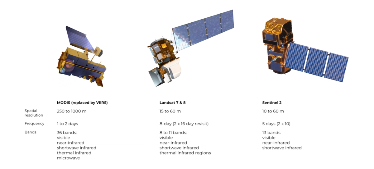
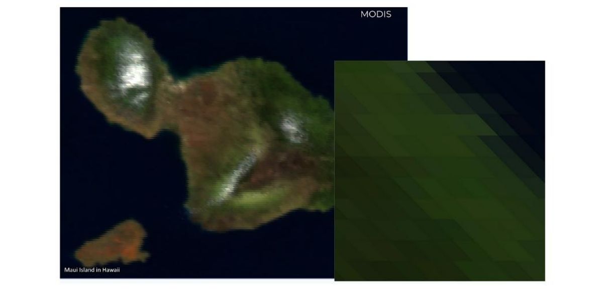
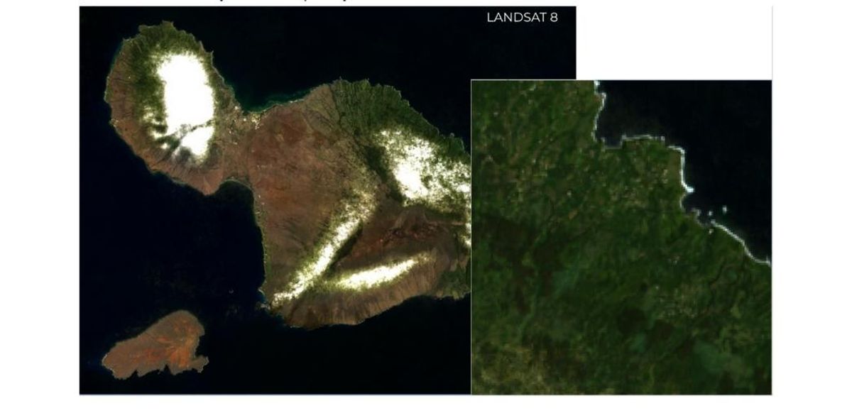
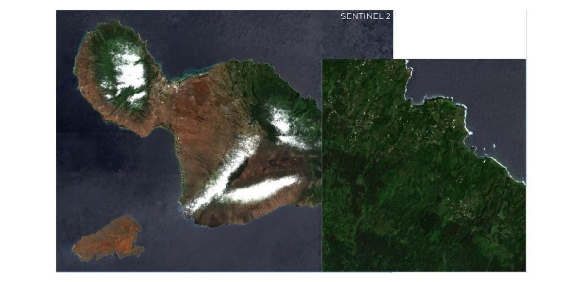
Several passive satellites are used for forest monitoring:
Vegetation indices play a critical role in utilizing RS data for assessing forest health, land use classification, disturbance, risk monitoring, and more. These indices provide valuable insights into the state of vegetation and the environment.
Vegetation indices are incredibly versatile, with over 150 indices documented in the literature. They change over time, which increases their utility, though some may need adjustments for local environments. These indices are often visually interpretable and can significantly enhance the performance of machine learning algorithms. However, they can be affected by cloud cover and shadows, as well as saturation issues.
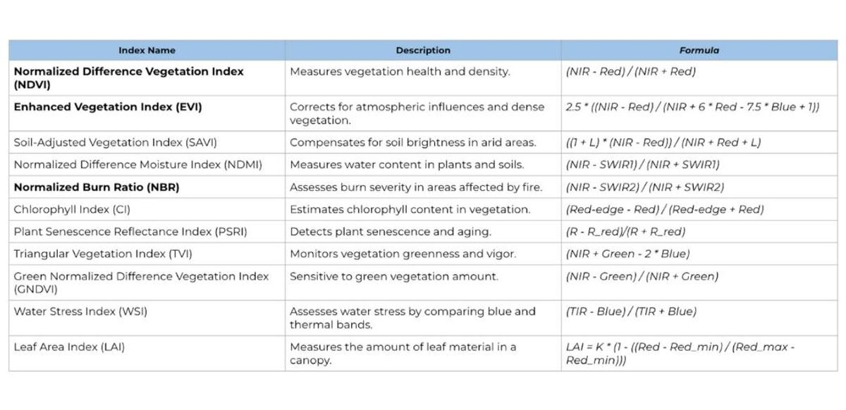
Use cases: Forest health, land use classification, disturbance, risk, monitoring
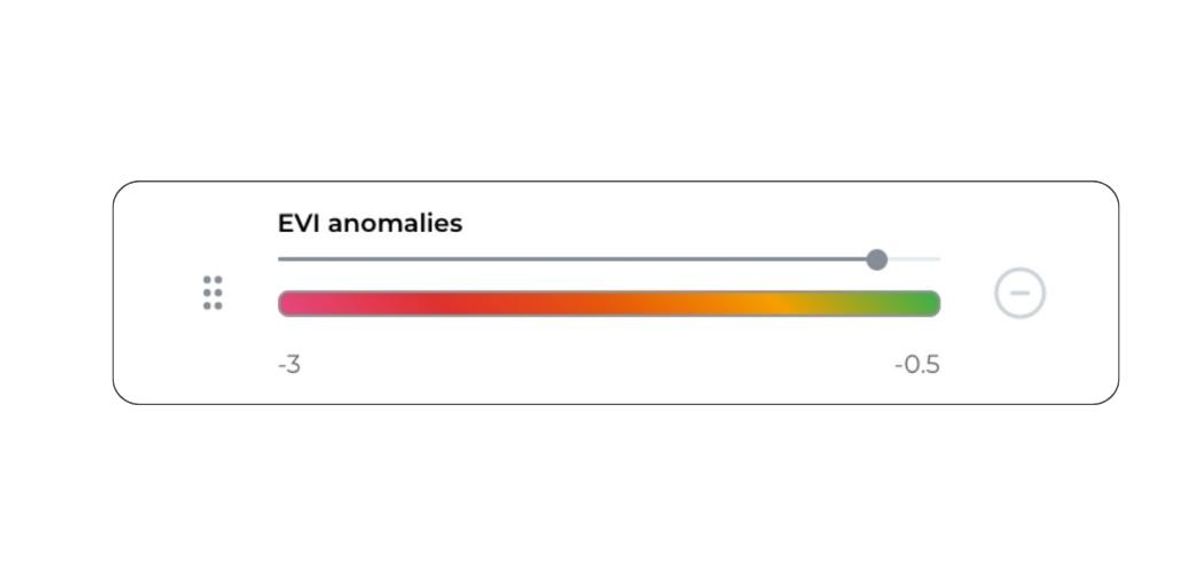
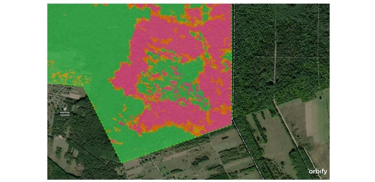
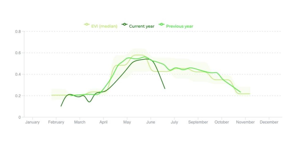
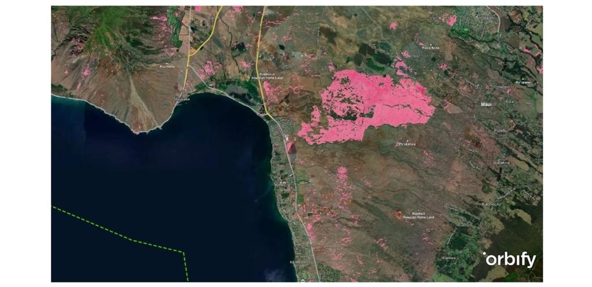
EVI anomaly data from Orbify
Vegetation Indices
Normalized Burn Ratio (NBR)
Machine learning and deep learning are ideal for land cover classification, especially in a dynamic world where the environment is constantly changing. These techniques are particularly useful for solving complex problems, such as tree species identification. Deep learning, which leverages convolutional neural networks, can extract textual information from RS images but requires high-resolution data, typically less than 3 meters per pixel.
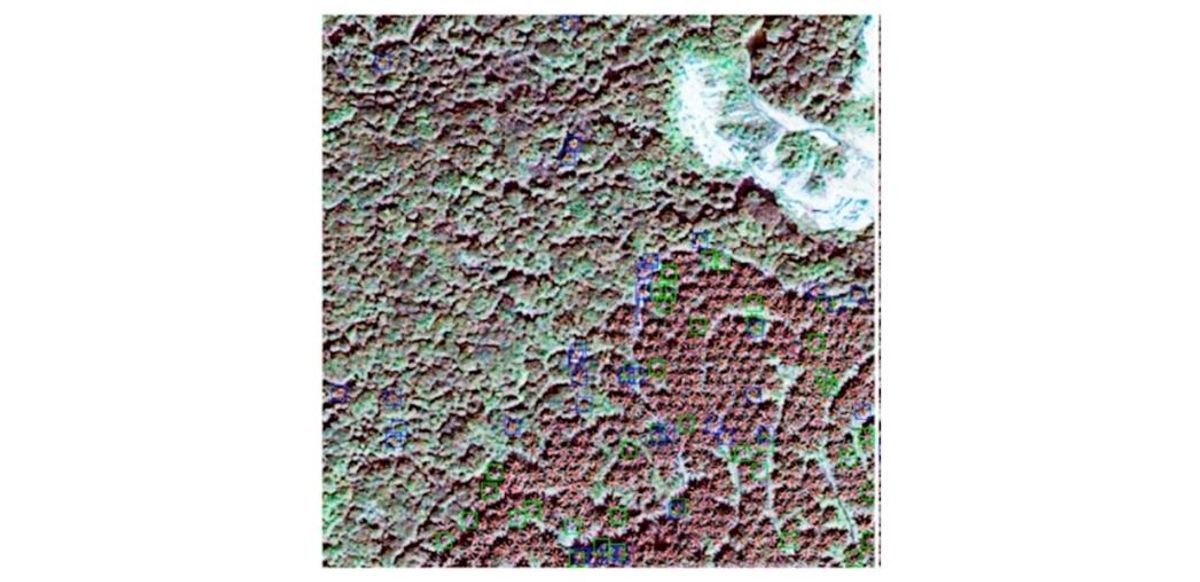
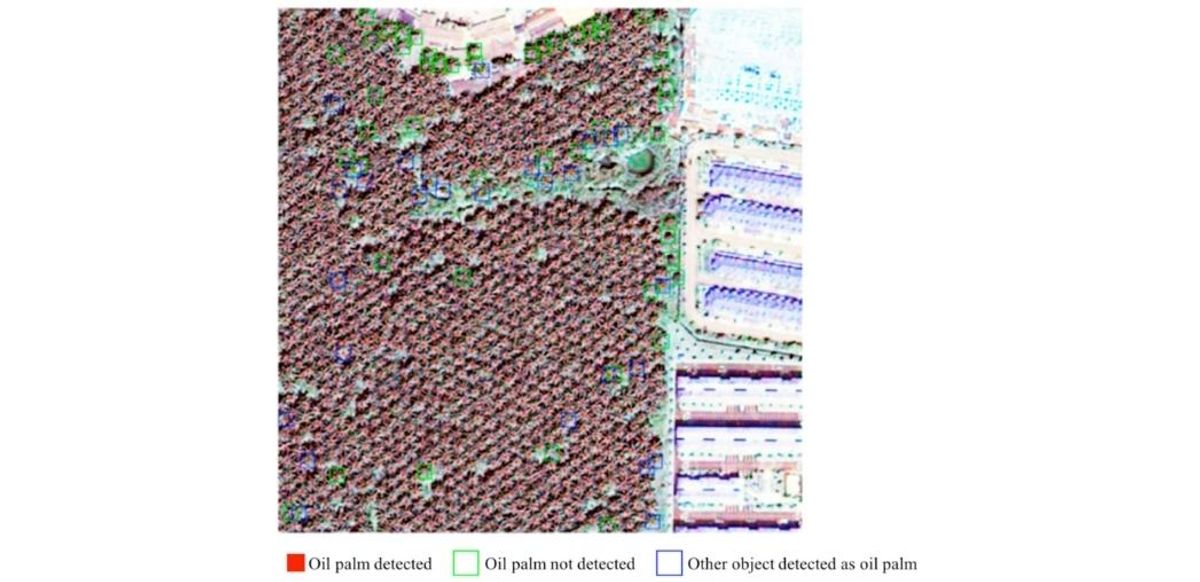
Two-stage convolutional neural network-based method (TS-CNN) for oil palm detection in large-scale study area (around 55 km2) located in Malaysia, using high-resolution satellite images (i.e., Quickbird). https://www.mdpi.com/2072-4292/11/1/11
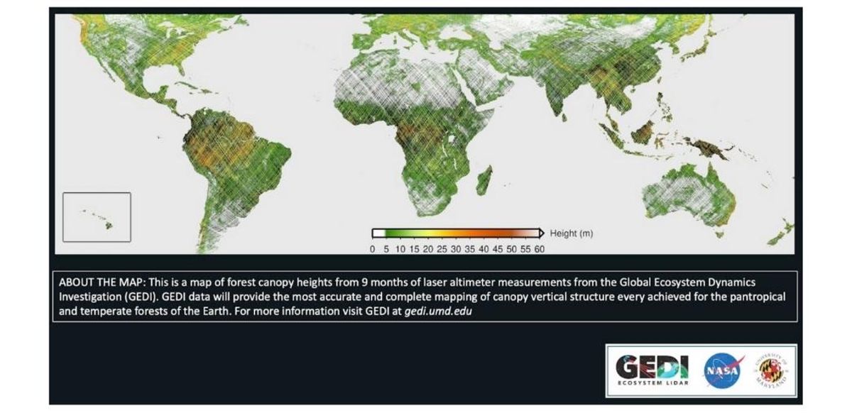
GEDI, a spaceborne LiDAR instrument, plays a crucial role in monitoring and assessing forest structure and biomass. This technology provides highly accurate and detailed data that is instrumental in environmental research.
Sentinel 1A, a C-band Synthetic Aperture Radar (SAR-C) satellite, offers all-weather monitoring and day-and-night imaging. It can penetrate vegetation, making it invaluable for monitoring forest structure and biomass, as well as detecting deforestation and forest degradation.
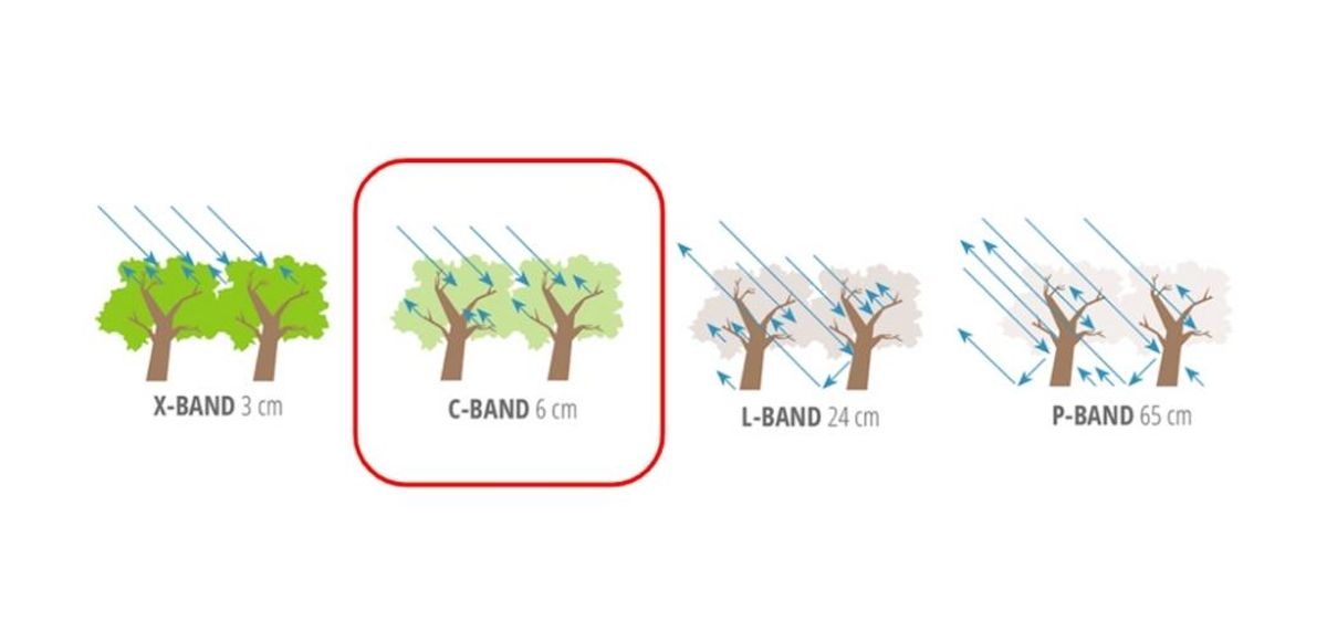
C-band (SAR-C): The C-band offers a good compromise between spatial resolution and penetration through vegetation and moderate cloud cover.
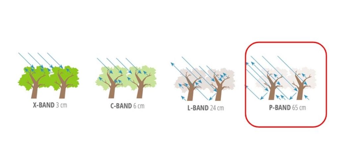
The upcoming ESA Biomass satellite, set to launch in 2024, will be the first P-band wavelength SAR satellite. This technology will enable the measurement of biomass at a remarkable 200-meter resolution, offering a new level of precision.
For the most accurate assessments, LiDAR and SAR data should be used in conjunction with ground truth datasets. These technologies provide valuable information about forest structure, which can be combined with ground truth data to generate precise Above Ground Biomass (AGB) maps. Projects like GEO-TREES offer global forest plot data for reference, but local ground truthing data is often necessary for specific projects.
In summary, remote sensing data and satellite technology offer a powerful set of tools for addressing environmental challenges. Passive satellites, vegetation indices, LiDAR, and SAR data are essential for monitoring forest health, land use, and environmental changes. Machine learning and deep learning techniques enhance the analysis of this data. By combining these resources, we can unlock the power of satellites for nature-based solutions, tailoring our approach to specific regions and challenges.
If you are interested in learning more about this subject, we recommend watching our recorded webinar session on "Why Are Satellites the Game-Changer for Effective Carbon Credit Assessment and Tree Growth Monitoring?", where we showcase the transformative power of satellites in NbS. Or, alternatively, schedule a personalized demo call with us.