Last edited: August 28, 2024
Published: March 13, 2024

Konstantinos Madias
Sustainability Copywriter
Blog Post
Last edited: August 28, 2024
Published: March 13, 2024
Konstantinos Madias
Sustainability Copywriter
Starting a carbon project is a significant endeavor, demanding thorough planning and investment.
Prior to starting your project journey, it's imperative to conduct a screening, including feasibility assessment, to ensure its viability and feasibility.
A comprehensive feasibility study is needed for addressing key questions that underpin a successful assessment of your carbon project. During this study is important to examine several components.
...but, what about rapid feasibility assessment using satellite data?
Without satellite data insights, stakeholders would rely solely on traditional methods, which often involve time-consuming processes like manual data collection and analysis. This can lead to delays in decision-making and less accurate information for guiding project paths.
When using platforms that can provide insights from satellite data, stakeholders gain access to processed and analyzed information making the decision-making process faster and more efficient.
By leveraging these insights, stakeholders can make informed decisions promptly, saving valuable time and resources.
Baseline Setting
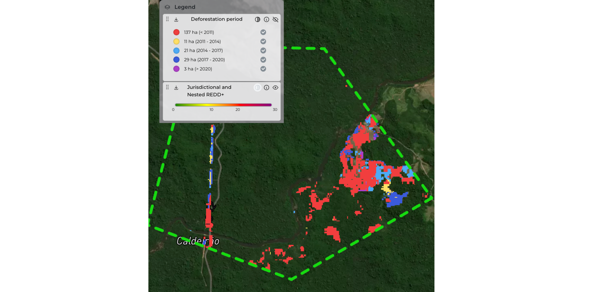
Satellite data examines historical deforestation rates within the project area and its surroundings, establishing a comprehensive baseline for effective mitigation strategies. Understanding the real landscape context is key. For REDD+ projects, this means assessing deforestation trends, while for ARR it involves evaluating the community involvement. By considering these factors, satellite data ensures informed decision-making.
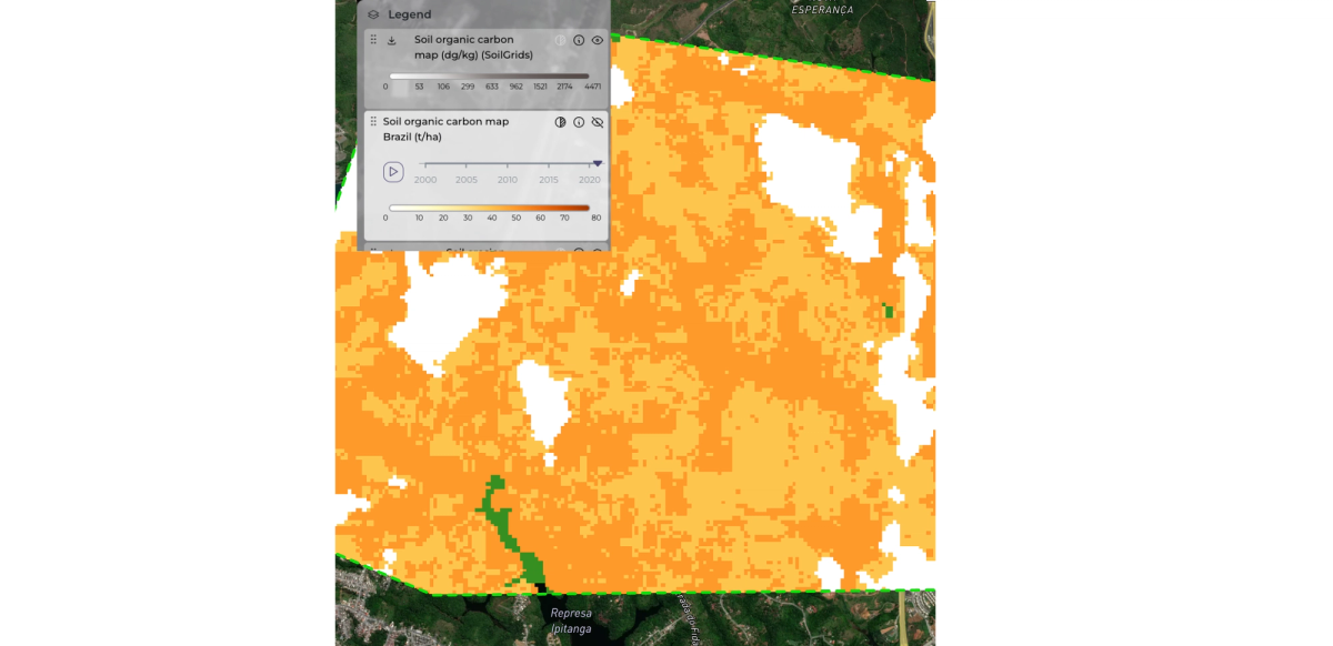
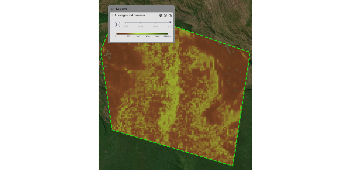
Carbon Stock Assessment
Satellite data provides estimations of carbon stock in forests and ecosystems, enabling monitoring of reforestation and forest growth. These assessments can help understanding the carbon sequestered over time. Identifying areas with high carbon stock allows for optimization of activities, and supporting effective carbon offset initiatives.
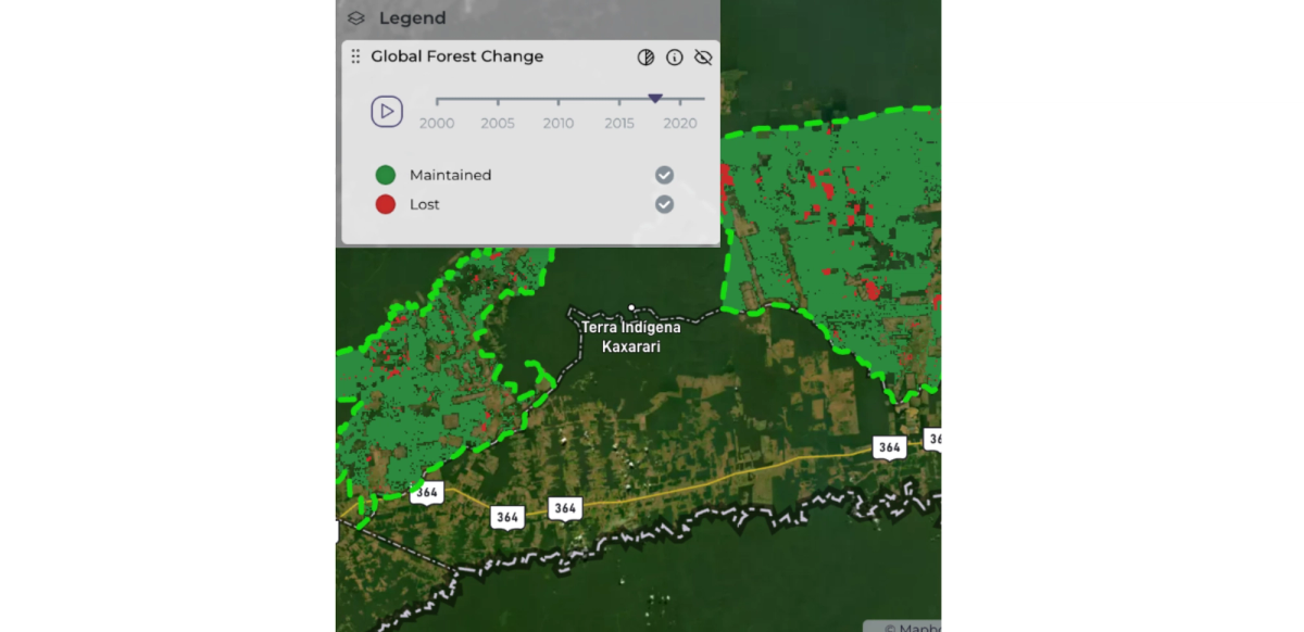
Leakage Area Analysis
Satellite data examines environmental factors like biomass and vegetation density, offering insights to enhance overall project sustainability. This comprehensive analysis identifies areas where environmental benefits might be compromised beyond project boundaries, allowing for targeted mitigation strategies to preserve ecosystem integrity and maximize project impact.
Risk Assessment and Monitoring
Satellite data identifies all potential permanence risks, including natural hazards and human-induced threats, through spatial analysis. This comprehensive assessment aids in developing targeted mitigation strategies to ensure project viability. Using historical data for risk prediction and ongoing monitoring via satellite imagery ensures effectively mitigating of potential risks.
In conclusion, satellite-based feasibility assessments offer invaluable benefits by streamlining decision-making processes and providing stakeholders with timely, accurate, and processed information. By leveraging satellite data insights, stakeholders can make informed decisions promptly, ultimately saving valuable time and resources while enhancing the efficiency and effectiveness of feasibility studies.