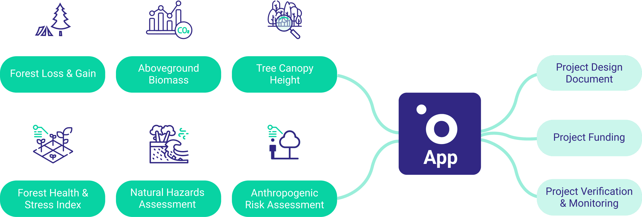
What you can do on Orbify
Strengthen Project Design
Streamline your project design and validation process with the ready-to-use analysis of remote sensing data optimised for REDD+ & ARR projects. Deliver PDD that is comprehensive, accurate, and aligned with the industry standards.
Accelerate Funding
Attract capital providers with ease by presenting your project through a powerful dashboard of Orbify Verified© indicators. With this new level of transparency, you can effectively showcase your project's potential and secure the support you need to implement it.
Monitor Progress & Trends
Effectively measure the progress of your NbS against the established performance & impact indicators, and produce ongoing reports for your stakeholders. Set up near-real-time monitoring alerts to identify possible vegetation stress & mitigate natural hazards risks.
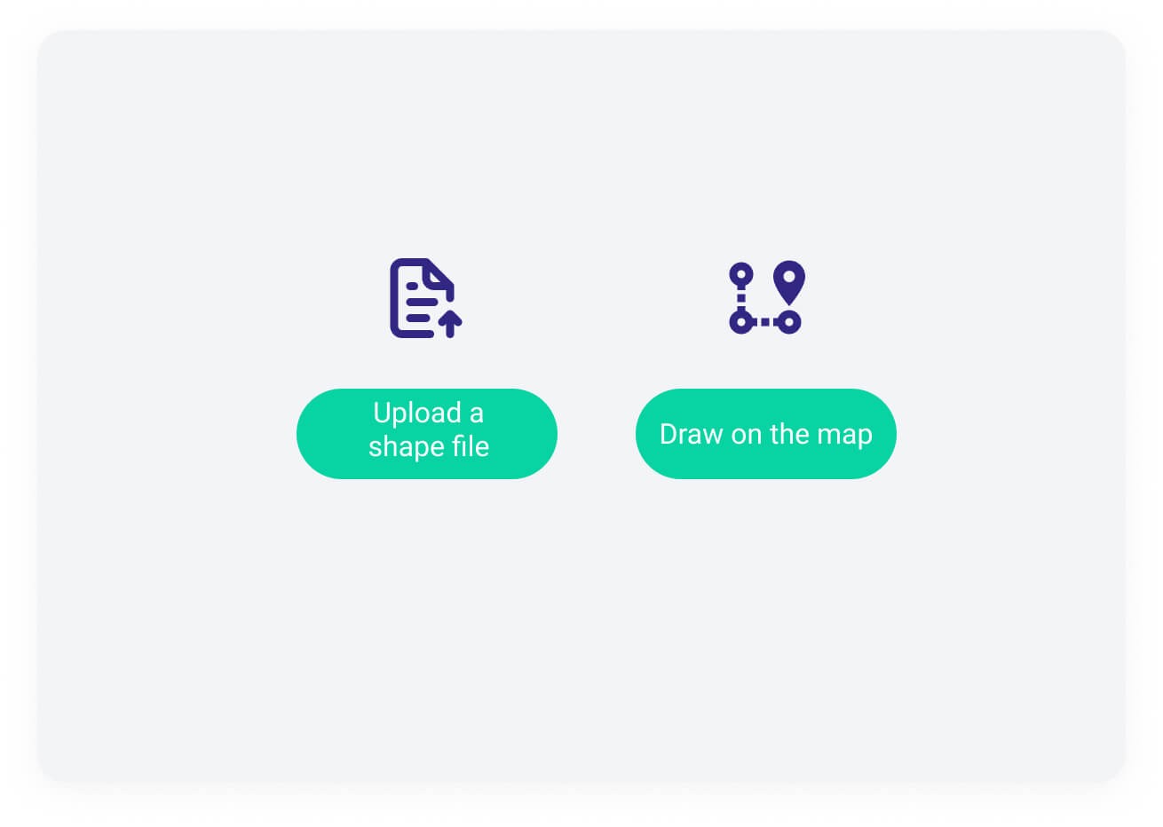
How it works
Step 1
Define your project's area
Step 2
Choose from the standard & premium indicators and upload your field data
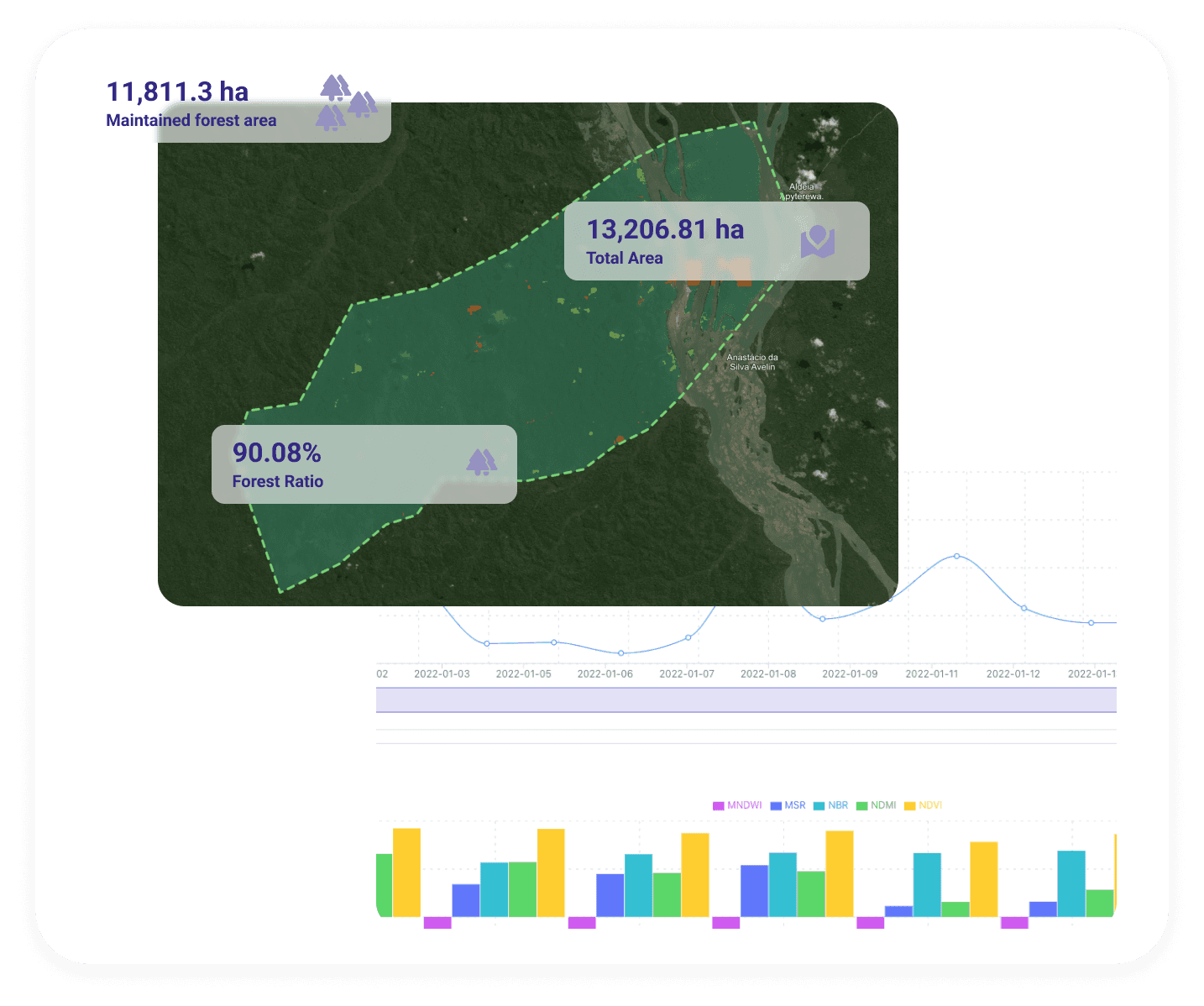
Step 3
Take a deep dive into the data insights
Step 4
Generate a report or activate an API integration
One data platform to empower NbS
Designed to accommodate NbS methodologies from numerous global standards.
AI-powered remote sensing analysis of forests of all sizes and complexity .
Reliable, independent and unbelievably cost-effective.
What our customers are saying

Orbify's platform is user-friendly, visually appealing, and scales well to host our data needs (high-resolution land cover for the conterminous US). We particularly enjoy being able to share and explore the data in its entirety, as well as distributing portions to our clients with ease.

Regardless of whether you’re working with SAR or optical imagery, this is the missing link in the Earth Observation tech stack. On top of great product, Orbify has an amazing team of dedicated experts who provided us with support when working with advanced processing.

What makes Orbify stand out for us is that they take care of the entire technology stack. By letting Orbify take care of everything from frontend to the backend, user management and more, we can focus on the analytical algorithms that we are building.

By using Orbify’s application templates, we were able to quickly design the application we were looking for and create an intuitive user interface that enables city planners to quickly take advantage of insights around air data quality for their area of interest.
Why Orbify?
Save time & money
Say goodbye to costly and potentially unreliable field data collection, or the need to have remote sensing experts in-house. Get the ready-to-use analysis of your entire project area within a few clicks.
Gain confidence with reliable data
Our algorithms are calibrated using a variety of projects, ensuring accuracy and reliability. We provide complete transparency in our methodology and data selection.
Build trust with capital providers
Secure funding faster by building trust with potential investors through the Orbify Verified badge. Demonstrate your commitment to transparency and earn the confidence of capital providers.
Escape the tech headache
Our platform can be used by stakeholders from all backgrounds, no remote sensing experience required. Use it as an interactive dashboard, produce reports or enable an API integration